Route Overview
Region
Miles
Days Out
Recommended Tire Size
Season
Elevation Gain
Difficulty
7/10 Technical
Primary Surface(s)


Route Map
Route Details
The northern half of the Toiyabe Crest Trail (TCT) is open to bikes, and it’s a must-ride for anyone who loves remote singletrack traversals along the spine of a towering mountain range. This loop begins with a *steep* 4×4 road climb up Ophir Canyon to reach the TCT, followed by 35 miles of mostly singletrack on the TCT.
Any trail with the word crest in its name stands to be a grand one, and the Toiyabe Crest Trail (TCT) is just that. Although the southern half of the trail is closed to bikes within the Arc Dome Wilderness, the northern half of the trail ~35 miles is open to bikes. And it’s not just open to bikes, a group of passionate mountain bikers has been brushing the trail, doing some tread work, and resurrecting the trail as it was being reclaimed by the mountains. Yes, it’s only 35 miles, but it’s 35 miles that is well worth your time and energy – there are very, very few Great Basin ranges with rideable singletrack along their crest.
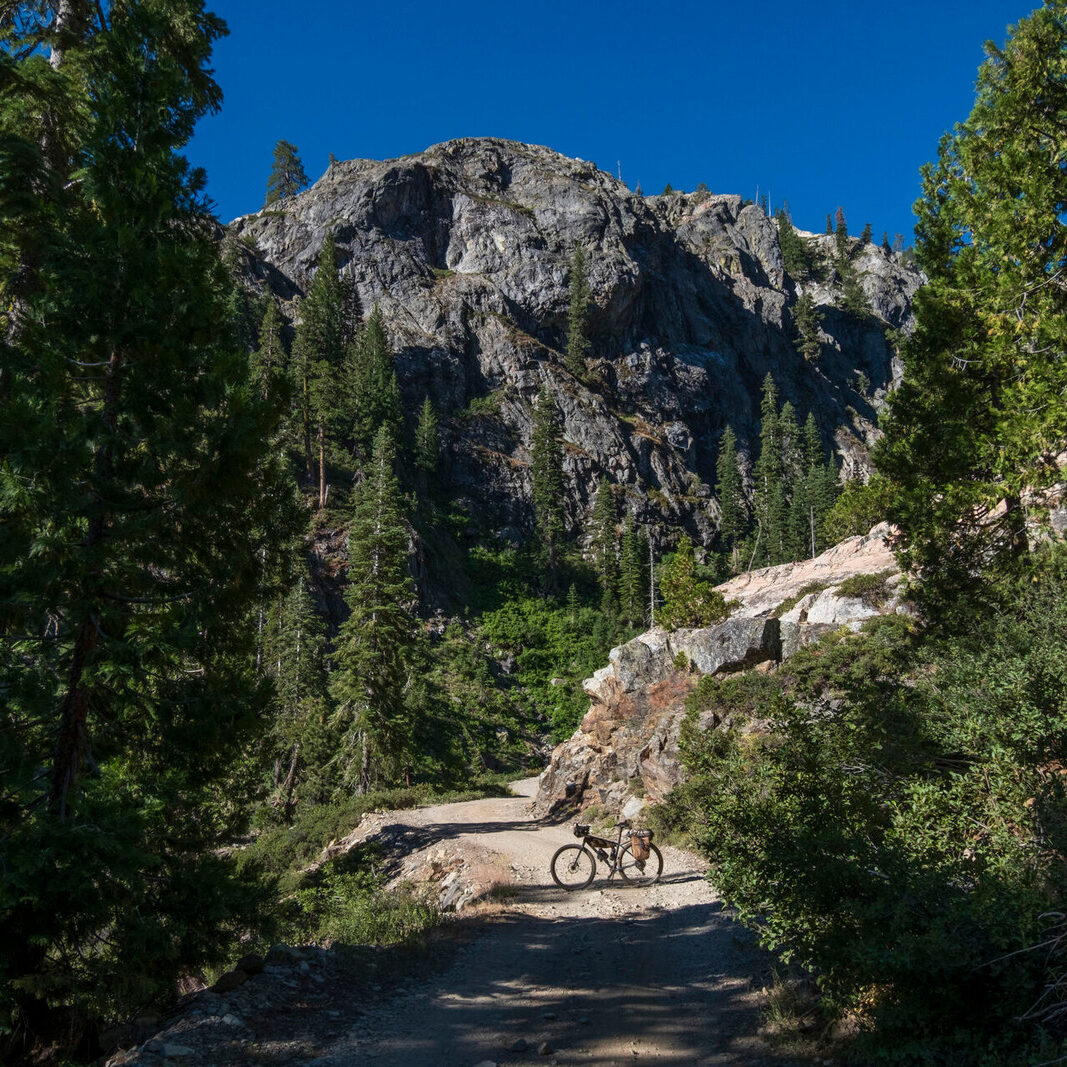
The route as described here starts at the base of Ophir Canyon at the southeastern edge of this loop and is best ridden clockwise. Parking on BLM land below the mouth of Ophir Canyon sets riders up for an incredibly steep climb up a 4×4 road, gaining 4,000 feet in 7 miles. Expect some hike-a-bike. There’s also water reliably in the lower part of Ophir Creek below the mining ghost town of Ophir. At the top of this immense climb, riders are above tree line, on top of the range, and at the TCT! Singletrack heads north from the road, climbing a bit more amidst huge views – more basins and more ranges as far as the eye can see in all directions. The trail is a ribbon of dirt in some places, loose rocks in others. After a few miles on the crest proper, the trail cuts down along the west side of the highest ridge and traverses steep sage-covered slopes from one aspen grove to the next. These groves glow vividly in October, giving vibrant color to the otherwise grey-green landscape.
The trail traverses a series of drainages on this west side of the range, and a few of them generally offer a small flow of water. Short sections of steep ATV trail and 4×4 track interrupt the more reasonably-graded singletrack. Past Washington Creek, a 1,500-foot singletrack climb ascends back to the top of the range through gnarled old-growth bristlecone pines before plunging 3,000′ down to the northern end of the TCT at Big Creek Road (a small trailhead parking area here offers another convenient place to start/end this loop).
The remainder of the loop is on roads – a few miles down to the old mining town of Kingston, and then 22 miles south on the relatively quiet Hwy 379. Kingston is mostly homes and cabins, but there’s a chance the old Lucky Spur Saloon will be open when you pass through.
If you’d rather just ride a piece of the TCT, a nice day ride to get a taste of the trail is on the west side of the range up San Juan Creek (mostly 4×4 road with some trail toward the end), north on the TCT, and down the Washington Gulch Trail.
- Paved: 30%
- Smooth Gravel: 10%
- Rough Gravel: 0%
- 4×4 Road: 10%
- Singletrack: 50%
See the “Additional Route Information” section of the route website for more information on water, camping, public lands, safety considerations and more.
- This route is part of a collection of routes on the Backcountry-MTB website. Please see more details on the route webpage.
- Please find the route on Ride with GPS: Toiyabe Crest Tail Loop
Kurt Refsnider created and stewards this route.
Kurt is Bikepacking Roots’ Routes Director and co-founder. He’s dedicated years to developing bikepacking routes and guides for other riders including the Western Wildlands Route, the Bears Ears Loops, the Northwoods Route, and many shorter routes. His passion is riding in wild, remote landscapes, and many of his route visions aim to help others experience places, connect to those landscapes, and recognize why the conservation of such places is so important.
Please get in touch with any updates on route conditions that may be relevant to other riders.
Unfortunately, Kurt is not available to help folks with trip planning questions.
Please submit your questions and comments on the route to Kurt through the comment form below.
This route traverses the traditional lands of the Western Shoshone.