Route Overview
Region
Miles
Days Out
Recommended Tire Size
Minimum: 2.2``
Season
September - Early October
Elevation Gain
Difficulty
5/10 Technical
Primary Surface(s)


Route Map
Route Details
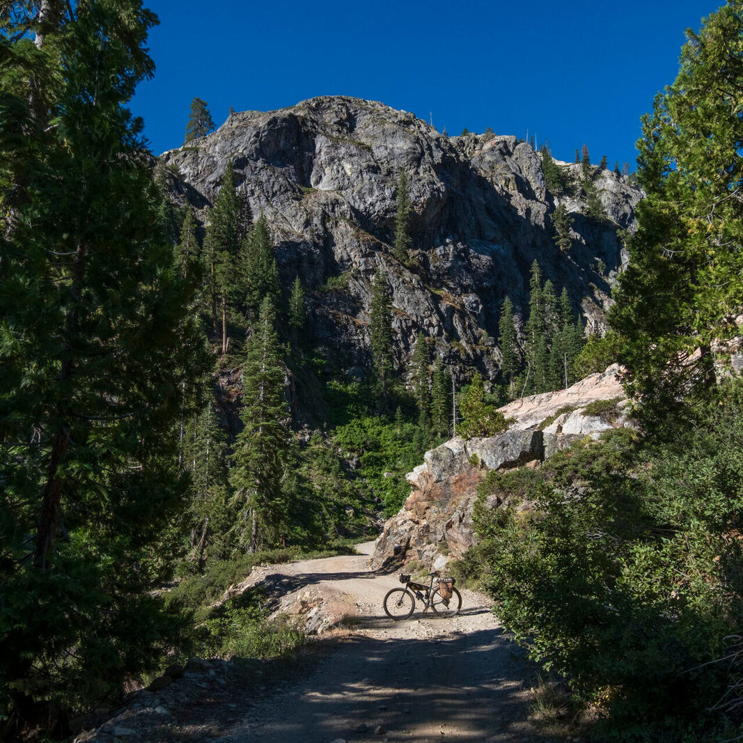
Bikepackers will traverse through miles of subalpine meadows lined with conifers and aspens, travel through dense ponderosa pine forests, ride along trout-filled rivers and lakes, and get endless high-elevation views. Cyclists will ride up to 10,000 feet on Escudilla Mountain and down to 5,800 feet along the Blue River near the last federally-designated Primitive Area in the United States. Look forward to riding along the banks of the Black River, staring at the complex neon greens of Hannagan Meadow, seeing the ecological succession of montane forests after the Wallow Fire, riding the perimeter of high-altitude Terry Flat, passing by enormous lakes in big sky country, and catching glimpses of wildlife such as Mexican Wolves, Black Bears, Mountain Lions, Elk, Big Horn Sheep, and Deer.
This bikepacking loop-us (“lupus”) heads through the high elevation heart of the White Mountains, Blue Range, and Mogollon Rim of eastern Arizona where the Mexican Gray Wolf has been reintroduced. The route name is a play on words as it is a “loop” involving the goal of seeing wolves (Canis lupus), especially the Mexican Gray Wolf which is commonly called “El Lobo.” The Mexican Wolf is a highly endangered subspecies of the Gray Wolf. It was nearly wiped out by predator-eradication programs, but the species was reintroduced to Arizona and New Mexico in 1998 and has slowly increased to a population of over 200. Riders will travel through the territory of El Lobo- mountainous terrain known as the “Alps of Arizona.” This land encompasses not only tributary headwaters of the Gila and Little Colorado Rivers but also some of the tallest peaks in Arizona at Escudilla and Baldy.
The goals of the route are to:
– Wrap and weave through the heart of Mexican Wolf (El Lobo) territory in eastern Arizona.
– Travel through the high-altitude “Alps of Arizona” for a rare southwestern summer bikepacking route.
– Hit up the most scenic, notable, and beautiful areas found in the White Mountains.
The recommended tire size is 2.4″-2.6″ with a minimum tire size of 2.2″. El Lobo Lupus is intended to be ridden in a clockwise direction. The White Mountains of the Apache-Sitgreaves National Forest have a network of broad, relatively smooth forest roads that El Lobo Lupus primarily follows. These roads are either hero dirt that is hard-packed and suitable for skinny tires, or loosely graveled with little washboard. Most of the sections requiring pavement stick to roads and highways with broad shoulders or sidewalks. When shoulders are absent, paved roads tend to be in areas with fewer vehicles. Wear bright colors, use flashing lights, and ride defensively as proactive measures for safety along paved roads.
There are a few sections of rocky 4WD roads. They frequent the burn scars and lower elevations of the route, especially where ATVs are common. Expect long lengths of washboard, decaying road, and erosion. These will be bumpy but short-lived compared to the rest of the route.
If rain/snow are forecast, the lower elevation portions of the route may become peanut butter/death mud and impassable in places. This is especially true around Show Low, Pinetop, Vernon, Springerville, and Sipe White Mountain Wildlife Area. Leave No Trace and avoid riding at these times until the route dries out.
The technical difficulty of the route is due to the presence of sections of singletrack along the Apache Railroad Trail and several portions of the route that take rocky and steep 4×4 roads through burn scars up in the mountains. Luckily, these sections are infrequent and eclipsed by the common, broad, and well-maintained dirt roads that make up the majority of the route. These US Forest Service roads are typically in great shape and rarely rutted. Hero dirt and hard-packed smooth substrate make up a majority of the backroads that El Lobo Lupus sticks to.
The physical difficulty is mostly due to the amount of climbing on this route and some of the grades of the climbs – such is the payment for enjoying high-meadowed peaks and river-filled valleys. The White Mountains, Blue Range, and Mogollon Rim are high-elevation areas along a rugged mountainscape of crumpled land. Climbing long ascents each day is assured and should be expected. Some noteworthy climbs will take a good portion of the day to ascend and feature steep grades; these sharp inclines may warrant hike-a-bikes, depending on your energy level.
- Paved: 22%
- Smooth Gravel: 63
- Rough Gravel: 10%
- 4×4 Road: 3%
- Singletrack: 2%
Water
Due to their elevation and geological composition, the White Mountains are rich with water sources. There are numerous springs, ponds, lakes, rivers, creeks, and streams. Many are reliable or definite. This is still Arizona and the southwest, though – it can get hot and exposed on a sunny day. Plus, there is lots of climbing. Make sure to carry a few liters at a time and plan ahead for how far it is to the next water source. Most of the seasonal water sources noted on the RWGPS map will run in early summer after a wet winter, but may be completely dry after a dry winter or further into the hot summer; don’t rely on these too much.
You may see lakes, reservoirs, or streams that I haven’t tagged with a POI on the map. That’s often because these are more marsh-like with muddy/murky, plant-choked shores that would make obtaining water difficult. I avoided tagging these sources in lieu of clearer, more accessible sources.
Camping
There are numerous awesome and free dispersed camping opportunities throughout this route. The Apache-Sitgreaves National Forest allows dispersed camping nearly everywhere. The only exceptions are the Mount Baldy/Lee Valley Recreation Area, the Greer Recreation Area, the Black River Recreation Area, and Sipe White Mountain Wildlife Area. There will be prominent signs delineating these boundaries; signs will indicate that camping is only allowed in designated sites. Don’t dispersed camp in these zones.
Beyond that, there are copious free camping opportunities. I’ve put POIs on the map for noted USFS campgrounds that El Lobo Lupus passes. Some of these have a fee to stay in and others do not. There are a few lodging opportunities along the route at USFS cabins and motels in Springerville, Alpine, Greer, and Hannagan Meadow. Call ahead to make reservations because these fill up quick during the summer season.
Food Resupplies
Most food resupplies on this route are only a few days apart. The largest resupply distance is during the last part between Alpine and Big Lake.
Fees and Permits
There are no fees or permits to ride this route through the Apache-Sitgreaves National Forest.
Parking
I’ve secured permission from the Show Low Elks Lodge No. 2090 for bikepackers to park their cars on the premises. There is a $4 per night fee per vehicle for parking. Make sure to contact Catherine Cribbs via email ([email protected]) beforehand to secure permission and talk logistics; she’ll be your point person. Let her know that you are a cyclist looking to ride/bikepack the El Lobo Lupus and the start/end dates for leaving your vehicle. However, this parking will be dependent on space. If there is a banquet hall rental or an event at the Elks, then cyclists will need to find another location to park.
A huge THANK YOU to the Show Low Elks for providing this parking!
Other Important Information
– Hunting Season: Starts in September and goes through December. The White Mountains are a premier destination for big game hunting. Expect the forest in the autumn to be filled with hunters. You’ll see more trucks, backcountry campers, ATVs, and individuals on foot. WEAR ORANGE and make yourself visible as you ride. Be smart and be seen during hunting season. Water sources and meadows may have more hunters scoping them out.
– Attitudes about Wolves: There are some real, open, hostile, and even aggressive sentiments against the Mexican Wolf in many places along this route. You’ll routinely see signs posted by the Arizona Game and Fish Department offering $48,000 rewards for information leading to individuals illegally killing lobos (and these killings to do happen). You can expect to see posters, signs, banners, poems, and more reflecting some individuals’ desires to exterminate or remove the wolves. There is also strong anti-US Forest Service and anti-government sentiment reflected in the decorum of some of the businesses of the towns you pass through. Make no mistake, livestock killings by wolves do happen, and it impacts people’s lives. Predator reintroduction is complex, difficult, and requires both science, politics, and relationship-building. Make sure to read the social situations you are in and judge how open you want to be about the wolves.
– Bears and Food Storage: Black bears are abundant throughout this entire route. Have a sure and proven method to safely secure and store your food each evening when you camp. This could be a bear hang, a bear canister, or an Ursack. All the campgrounds require food storage and have signs posted everywhere about being in “bear country.”
Access
There are no specific restrictions for bicycles on this route. The Apache-Sitgreaves National Forest allows bicycles in most areas without limitation. The roads used on this route are open to most motorized vehicles. In sections where motorized vehicles are prohibited, bicycle-travel is permitted. There are four areas near the route (not on it) that are federally designated Wilderness – this means any travel in those areas must be non-mechanized (i.e. hiking or equestrian). They are:
• Mount Baldy Wilderness
• Escudilla Wilderness
• Bear Wallow Wilderness
• Blue Range Primitive Area (managed as Wilderness)
The route does travel near the Fort Apache Reservation (home to the White Mountain Apache Tribe) and the San Carlos Reservation (home to the San Carlos Apache). There are many dirt roads that lead continuously from the Apache-Sitgreaves National Forest into both of these Tribal Lands. Respect Tribal Lands and do not ride without permission into these areas. There are permits available from the White Mountain Apache Tribe for boating, fishing, and camping on their land, but these must be obtained in advance.
- Please see the route webpage on Forrest’s website for even more resources and info.
- Get the route on Ride With GPS.
- El Lobo Lupus is also on Instagram.
- Forrest has secured permission from the Show Low Elks Lodge No. 2090 for bikepackers to park their cars on the premises. There is a $4 per night fee per vehicle for parking. Make sure to contact Catherine Cribbs via email ([email protected]) beforehand to secure permission and talk logistics; she’ll be your point person. Let her know that you are a cyclist looking to ride/bikepack the El Lobo Lupus and the start/end dates for leaving your vehicle. However, this parking will be dependent on space. If there is a banquet hall rental or an event at the Elks, then cyclists will need to find another location to park. A huge THANK YOU to the Show Low Elks for providing this parking!
Forrest Radarian created and stewards this route as well as the Canyon bikepacking routes (South and North Rims) at Grand Canyon National Park. Here is a little about Forrest in his own words:
I live and work at the South Rim of the Grand Canyon as a high school science teacher for the only public preK-12 school located in a National Park. I am passionate about teaching, working with students in the sciences, and connecting them to the outdoors. I bike and hike extensively in the area, and I’m committed to riding, refining, and stewarding routes on both Rims. I plan to continue to bike both routes yearly, work with my connections in the Park and Forest Service, and update route information in a timely fashion.
When I first visited the White Mountains of eastern Arizona years ago, I was shocked to see miles of big sky country at 9000 feet filled with meadows, punctuated by peaks, and spotted with large lakes – all existing in Arizona. Even more-so, I was thrilled by the presence of wolves in this state and the reintroduction efforts for el lobo. I keenly remember peering down a dirt road just south of Alpine, AZ and imagining what it would be like to hear their howls on an overnight bike trip in that backcountry.
I live a few hours away from the White Mountains, and I typically visit the area several times a year. I plan to continue visiting this region to camp, hike, and bikepack – including keeping an eye on updates for the route. In addition, I have a friend who lives directly on the route (and rides the area frequently) who has agreed to help co-steward the route.
I first got into bike touring back in 2014 when I participated in the Great Ohio Bicycle Adventure and furthermore when I toured the Pacific Coast Highway in 2015. The tour of the PCH got cut short when my wife and I were hit by a car in the southern reaches of the route. We returned to finish, but the desire to adventure by bike off-pavement became stronger when I stumbled on dirt-specific bikepacking. I’ve since ridden a number of bikepacking routes around my home in Arizona and the surrounding southwest, in addition to a thru-hike of the Arizona Trail in 2019.
I want to thank Darren and Janna for all the day rides we rode over the years in the White Mountains. I know they listened to me gush for hours about the possibilities of seeing wolves and what a bikepacking route could look like in the area. Those rides became the backbone scouting experiences that helped me put together this route. I want to thank the Show Low Elks Lodge #2090 and Catherine Cribbs for providing parking for riders on this route! I want to thank Mike and Annette Enfield in Show Low for providing me a base to ride and scout this route; their hospitality was simply amazing. I want to further thank Mike for agreeing to be co-steward of this route.
Be sure to check out Forrest’s full webpage to read more about his bikepacking adventures.
Forrest has offered to be available to answer questions if you are planning a trip on this route. We encourage you to be respectful of Route Stewards time though and to review publicly available materials first before reaching out with questions.
Please also get in touch with any updates on route conditions that may be relevant to other riders.
Please submit your questions and comments on the route via the contact form below.
This route traverses the traditional lands of the White Mountain Apache, San Carlos Apache, Chiricahua Apache, Pueblos, and Shiwinna (Zuni) peoples.