Route Overview
Region
Miles
Days Out
Recommended Tire Size
Season
Elevation Gain
Difficulty
8/10 Technical
Primary Surface(s)


Route Map
Route Details
You’ll get a taste of Beverly Hills, Hollywood, Mulholland Drive, the Santa Monica pier, the L.A. River, and Griffith Park. You’ll even see a few filming locations and military sites. The L.A. area is an epicenter for all things entertainment, industry, transportation, education, diversity, and more.
Would you believe we have some of the best off-road cycling in the country too? Although it’s a metropolis with a population of just under 4 million people, infamous for its rich and famous, traffic congestion, and housing shortage – L.A. offers hundreds of thousands of acres of public land within cycling distance.
It is one of the few places on Earth where you can completely lose yourself in the wilderness while in one of the most population-dense areas of the world. You will experience coastal views that distract from the housing shortage, rugged foothills that overwhelm the suburbs, and mountains that dwarf the city’s skyscrapers. Whether you like dodging beach goers on the oceanfront, climbing endless coastal canyons, going totally aero on a road section, ripping chunky single track, or traversing endless forest roads, this route has it.
You’ll be transported to the vast and abundant public lands surrounding the area, highlighting the beauty, accessibility, and contrast of this land.
But don’t underestimate this route… just like Los Angeles real estate, the cost is steep… 300 miles with over 41,000 ft of elevation gain!
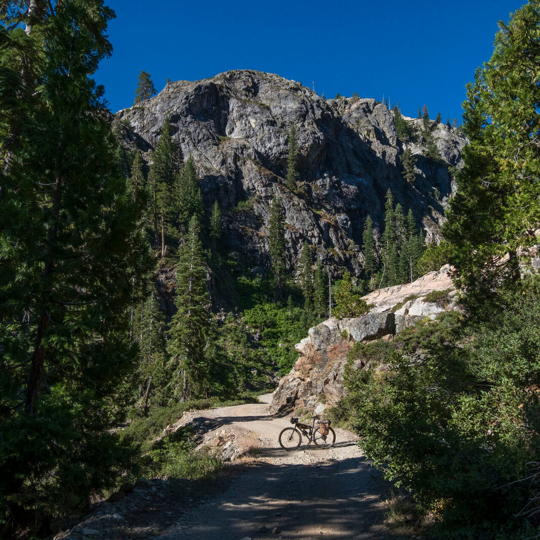
As has already been stated, this route has a bit of everything, but is heavy on single track and makes MUCH of any off-grid opportunities, which all lie in direct connection to some major cities. You will need your blinky light and comfort with riding on city streets with cars. Summer’s get into the 100’s, and winters will put snow on the San Gabriels (on route)… so your best chance to hit this will be in the shoulder seasons – spring & fall.
Jason and Gregg highly recommend a mountain bike. Gravelers will see the road bits and assume they can go for it on some 37’s… but the route was designed with MTB in mind. A hard tail w/ 100mm fork, dropper, and 2.4’s are what we think is the sweet spot.
Services are abundant along the route, with 2 major exceptions: the San Gabriels (north) and the Santa Monica (south) mountain ranges. Between these two ranges the route climbs 13,000-20,000 feet and covers miles 70-120 slowly. Riders will need to filter enough water and pack enough food for the roughly 24–48 hours it takes to cover those sections. Many water sources will stop flowing in summer, so fall could be a tougher carry.
Camping is available, and marked on the map, though it can be spread out at times. Details are outlined in the Logistics Section. Those looking to take a week to finish the route will need to utilize hotels/motels in the many cities that the route travels through.
Wildlife is present, mostly in skittish brown bears, deer, coyotes, and bobcats. There are mountain lions and rattlesnakes so watch where you put a foot down. There is often copious amounts of poison oak.
“Ride this if you’ve done other routes, and you want vert, technical single track, and you are WAY ok with city riding.
Ride this if you want to see LA from every conceivable angle.
Ride this if you want to be friends with the Escape from LA crew!”
- Paved: 40%
- Smooth Gravel: 0%
- Rough Gravel: 15%
- 4×4 Road: 10%
- Singletrack: 35%
Public parking is available at the official start of the route in Santa Monica parking garages. A few other POIs have been added to the RWGPS route file with suggested parking spots if you were looking to start the loop from another location.
This route can be ridden in either direction, the jury is still out on which direction is preferred. See the resources section for a link to the clockwise version of the route.
Do not underestimate this route! Be aware of the following conditions:
-
Water – “L.A. was not built in the desert, but the desert may be coming to us.” It is scorched here, and the sun beats you down. There will be long stretches without water. Pay attention and plan ahead.
- Big Tujunga is 100% reliable most years. The same can be said for a well by Mt. Lowe trail camp and the water fountain by Redbox/Mt. Wilson Road, but those aren’t as critical as Big Tujunga creek… that one’s at the beginning/end of a LONG section with no other “reliable” springs, only seasonal stuff. Riders should plan to carry 6–7 liters on a dry year. There are 42 miles and 8,400′ in elevation gain between water sources. It is pretty exposed to sun, too.
- Limited Camping – dispersed camping is not allowed in the San Gabriels, Santa Monica Mountains and other open spaces along the route. Please limit camping designated camp sites marked in the RWGPS file. If you are planning to tour the route at a slower pace, you should expect to supplement camping with indoor lodging as the route passes through towns along the route.
-
Cars – This route will take you through some high-traffic areas. Wear high visibility clothing and use flashing lights. Take the lane if needed and obey traffic laws. Use hand signals.
-
Vert – You will be walking your bike up some long stretches. You’ll be measuring this ride in the number of “10k days” rather than in miles. This may be among the steepest bikepacking routes in the country.
-
Fire – Know the fire regulations for the area before lighting any fires… they change based on the open space you happen to be in so do your research! Also, wildfires are a thing so don’t get burned!
-
Weather – It goes without saying, but temps could soar into the 100’s or dip into the 30’s, you could get snowed on or sunburned. Don’t fall asleep on this, or you’ll be sorry.
Local Bike shops are:
- AllezLA (Silver Lake)
- JRA Bikes & Brew (Thousand Oaks)
- Jason and Gregg maintain a detailed website for the route that can be found at: https://www.labikepackingsucks.com/
- You can find LA Bikepacking Sucks, and pictures from the Escape from LA route on Instagram @labikepackingsucks
- A clockwise version of the Escape from LA route can be found on RideWithGPS and on the LA Bikepacking Sucks website
- You can read a recap of the Inaugural 2023 Grand Depart on the route on Bikepacking.com
- Gregg wrote a journal entry on RideWithGPS: https://ridewithgps.com/
journal/9320-escaping-la
Trail maintenance orgs that Jason and Gregg support and champion are:
LA Bikepacking Sucks and the Escape from LA Route is a team effort between Gregg Dunham and Jason Shafer.
Gregg is an ITT holder for the Tour de Los Padres and 2021 winner of Stagecoach 400. He’s also the first finisher & current FKT holder of the New Colo route.
Jason is a more recent Bikepacker, starting in 2020. Multiple finishes in the top 10 of Stagecoach 400, and before that, an ultra endurance athlete in Ironman & marathon.
This route was inspired by tens of thousands of miles logged by us, who are locals to the LA area and used the land to train for bikepacking adventures in other locales. Given the sheer volume of incredible riding woven like a spider web throughout the greater Los Angeles area, it was only a matter of time before we realized, “why don’t we have a route right here?!”
One of the big catalysts for this route was an incredible idea championed by many throughout the last 40 years called the “Rim of the Valley” – a network of connected trails looping around the San Fernando Valley incorporating an inspiring level of cooperation between city, state, federal, and tribal land stewards. A solid entry point to this rabbit hole can be found here: https://storymaps.arcgis.com/stories/b1a5b96aa361447cb9eeb154ffa28077
We’re so excited to share this route with others!
Gregg’s a resident in Thousand Oaks, towards the west end of the route. Jason lives near Pasadena, at the East of the route. The two of us work together to keep tabs on all things Escape LA.
Jason Shafer and Gregg Dunham have offered to be available to answer questions if you are planning a trip on this route. We encourage you to be respectful of Route Stewards time though and to review publicly available materials first before reaching out with questions.
Please also get in touch with any updates on route conditions that may be relevant to other riders.
Please submit your questions and comments on the route via the contact form below.
This route traverses the traditional lands of the Tongva, Chumash, and Tataviam.