Route Overview
Region
Miles
Days Out
Recommended Tire Size
Season
Elevation Gain
Difficulty
3/10 Technical
Primary Surface(s)
~14% rough gravel


Route Map
Route Details
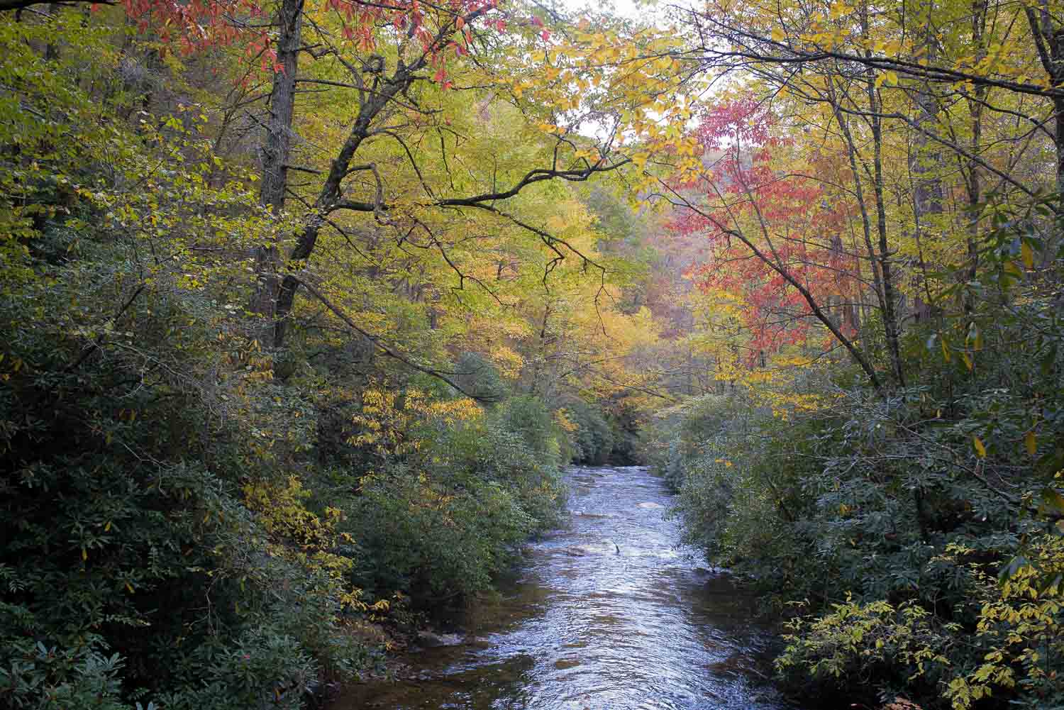
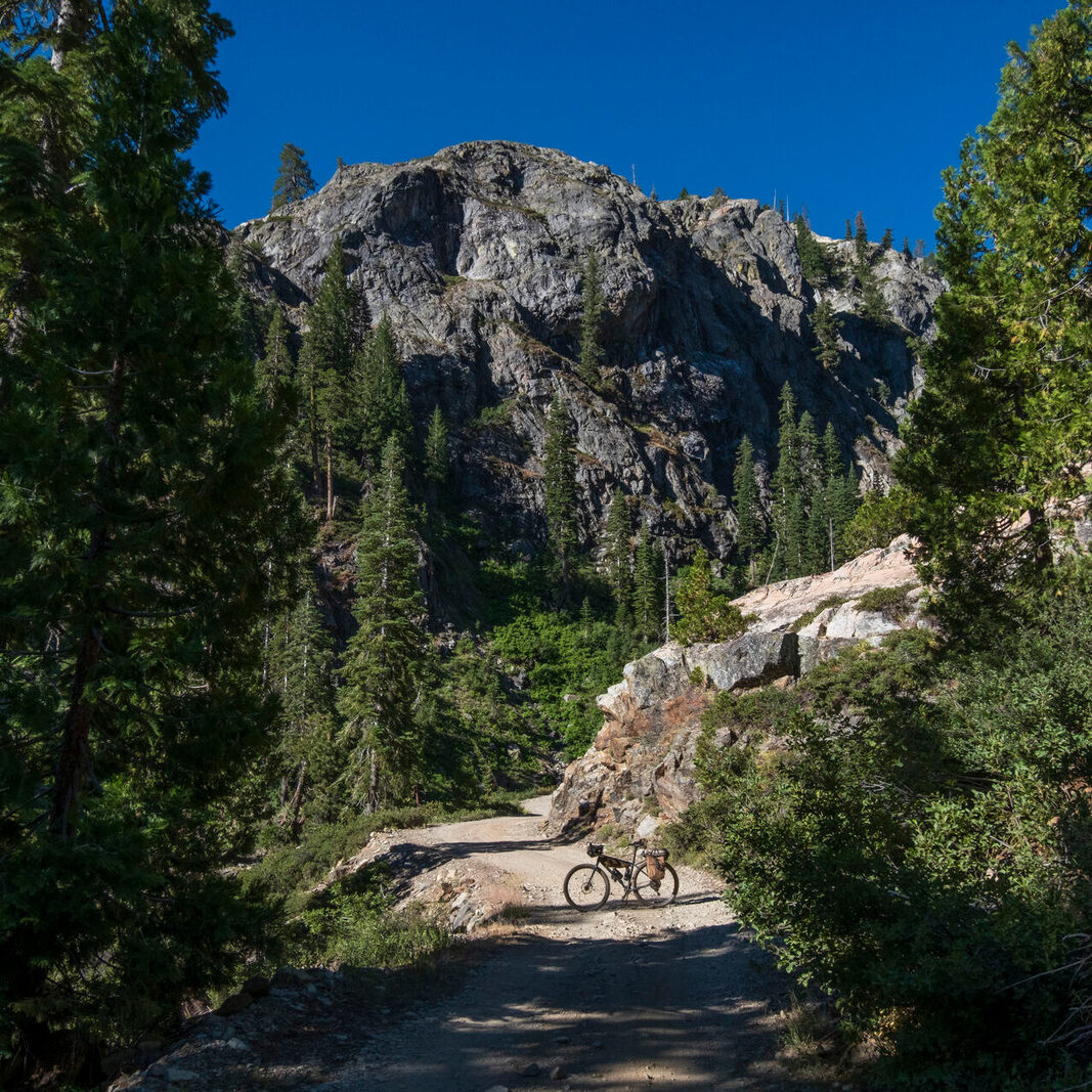
Roll Call is an overnight bikepacking trip starting from The Hub in Brevard, NC. Ridden counter clockwise you will climb up gravel roads and enjoy fast and flowy singletrack descents in the Pisgah National Forest, Ranger District. Camping options are sprinkled throughout the route at campgrounds or primitive riverside tent sites. Great views of Looking Glass Rock and riverside riding make this a favorite quick overnight in the area.
Highlights include:
- Flowy Singletrack Descents
- Riverside Camping/Swimming
- Looking Glass Rock Vista
- Downtown Brevard
- Oskar Blues Brewery
Once ready to roll you will head into Pisgah on route 276 and quickly turn onto gravel at Avery Creek. This begins your climb up to the Pisgah Forest Riding Stables where you’ll turn onto the Clawhammer climb. At the top of Clawhammer you will take the Buckhorn Gap Trail for a flowy singletrack descent to South Mills River. This leads you to Wolf Ford group campground where you have an opportunity to camp on the river off the Pink Beds singletrack or continue on via Yellowgap road (gravel).
A quick turn off 276 brings you to a short gravel climb then to a singletrack descent into the group camping area of Cove Creek. Follow the flowy Davidson River Trail to the last big climb on 475C. The route ends with an excellent descent on the Bracken Preserve which spits you out in downtown Brevard to finish off the trip on easy greenways to Oskar Blues Brewery or beers at The Hub.
- Paved: 9%
- Smooth Gravel: 68%
- Rough Gravel: 14%
- 4×4 Road: 0%
- Singletrack: 9%
- This route is ideal for an overnighter but can also be spread over 2 nights for a slower pace (but there is no resupply until Brevard).
- The Hub has given the green light to leave your vehicle in their gravel lot behind the store. However, it’s best to check in to let them know when you expect to be back.
- The Pink Beds section may include a wet water crossings. To avoid this, re-route to Yellow Gap Road and connect back with the route on 276.
- All marked primitive camp locations have a fire ring/pit and are free.
- Water is plentiful on the route. Bring a filter for water.
- More logistics information can be found via waypoints in the route’s RideWithGPS file.
Please see the RideWithGPS file or the RideWithGPS route overview page for more details.
Rockgeist also hosts a page for the route here.
Rockgeist (rockgeist.com) manufactures bikepacking gear in Asheville, NC and is dedicated to expanding the boundaries of your bicycle travel. This route is part of their route library (https://rockgeist.com/routes/) that focuses on short and accessible East Coast bikepacking routes. Greg Hardy, owner of Rockgeist, is committed on behalf of the Rockgeist team to ongoing stewardship of this route.
This route was initially developed and submitted to Rockgeist by Pisgah Productions (https://www.pisgahproductions.com). Pisgah Productions hosts premier gravel and off-road cycling events in Western North Carolina. Their owner, Eric Wever, was the first Rockgeist employee and has extensive knowledge of the best trails in the Pisgah National Forest.
Rockgeist has offered to be available to answer questions if you are planning a trip on this route. We encourage you to be respectful of Route Stewards time though and to review publicly available materials first before reaching out with questions.
Please also get in touch with any updates on route conditions that may be relevant to other riders.
Please submit your questions and comments on the route via the contract form below.
This route traverses the Miccosukee Territory.