Route Overview
Region
Miles
Days Out
Recommended Tire Size
Season
Elevation Gain
Difficulty
5/10 Technical
Primary Surface(s)
45% gravel

Route Map
Route Details
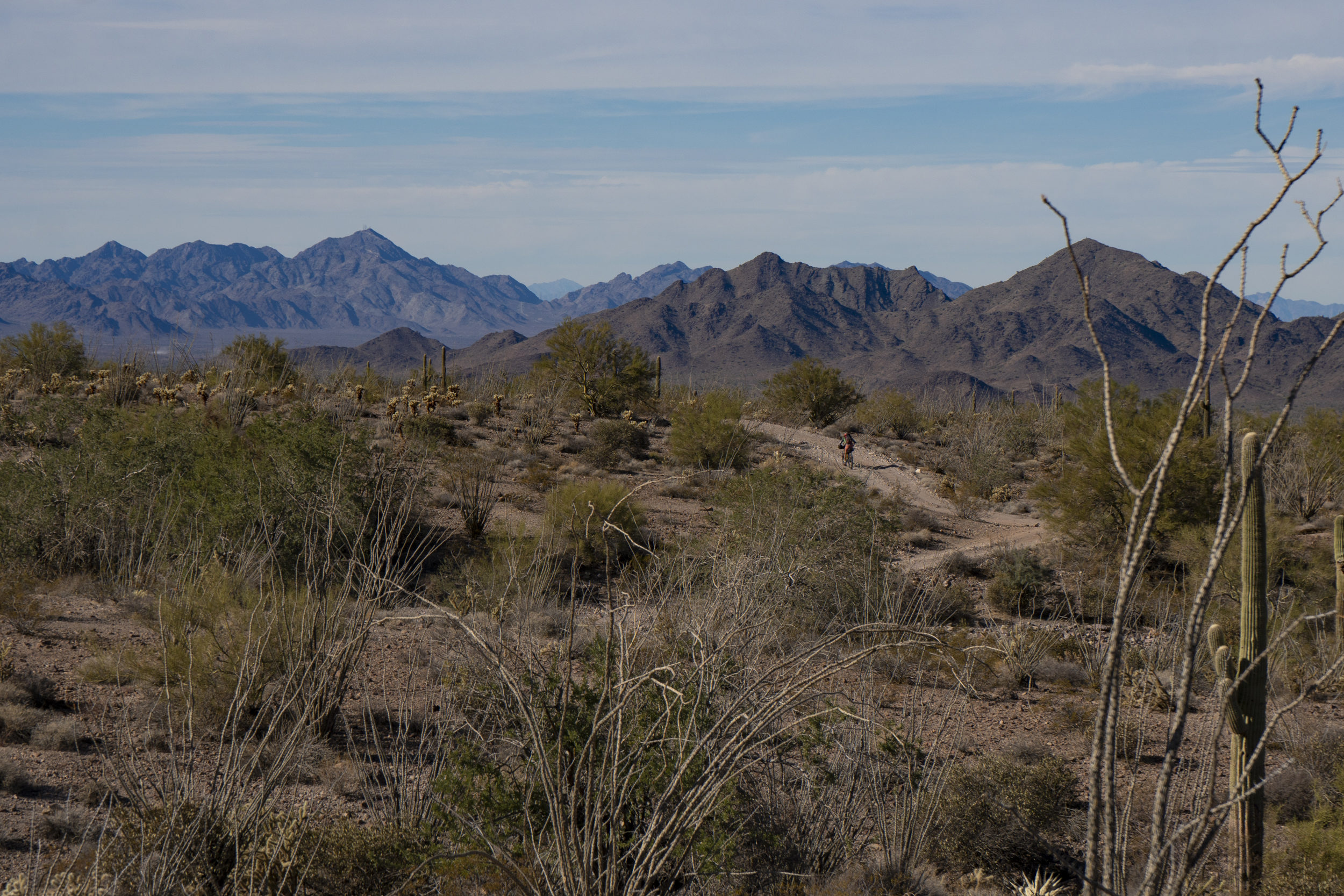
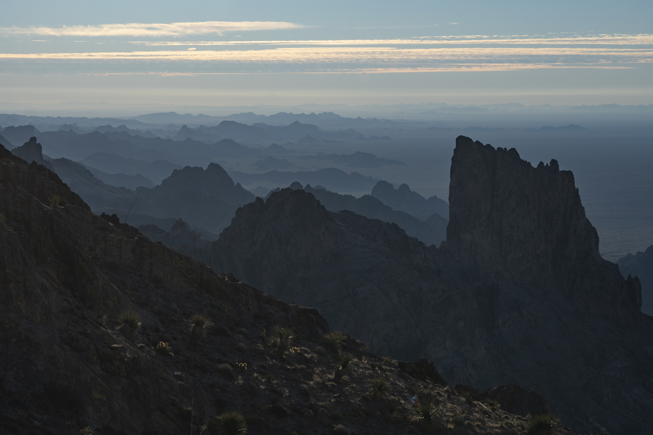
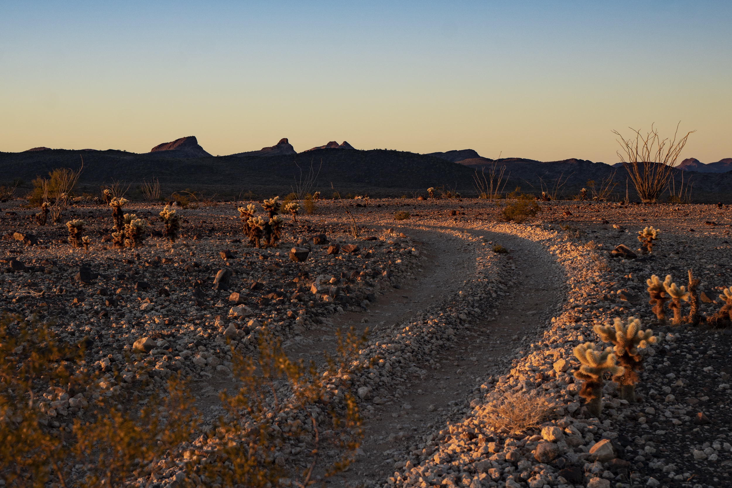
This delightful desert tour is on 100% dirt, 100% public lands, through stunning mountains, and with reliable water sources – it’s a fantastic 3- to 5-day winter bikepacking trip! The long version of the route includes 2-3 opportunities to scramble up desert peaks and hike into deep canyons along the way, and the shorter version bypasses those side adventures.
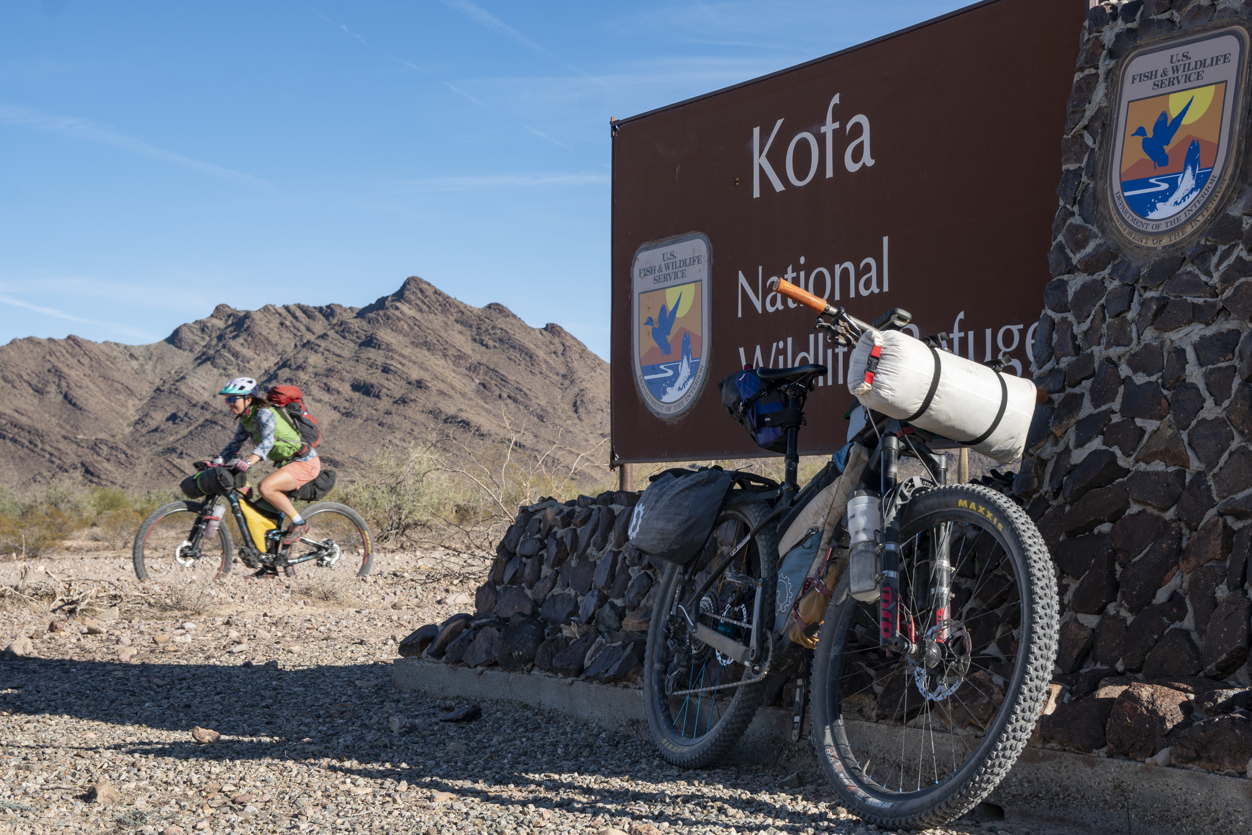
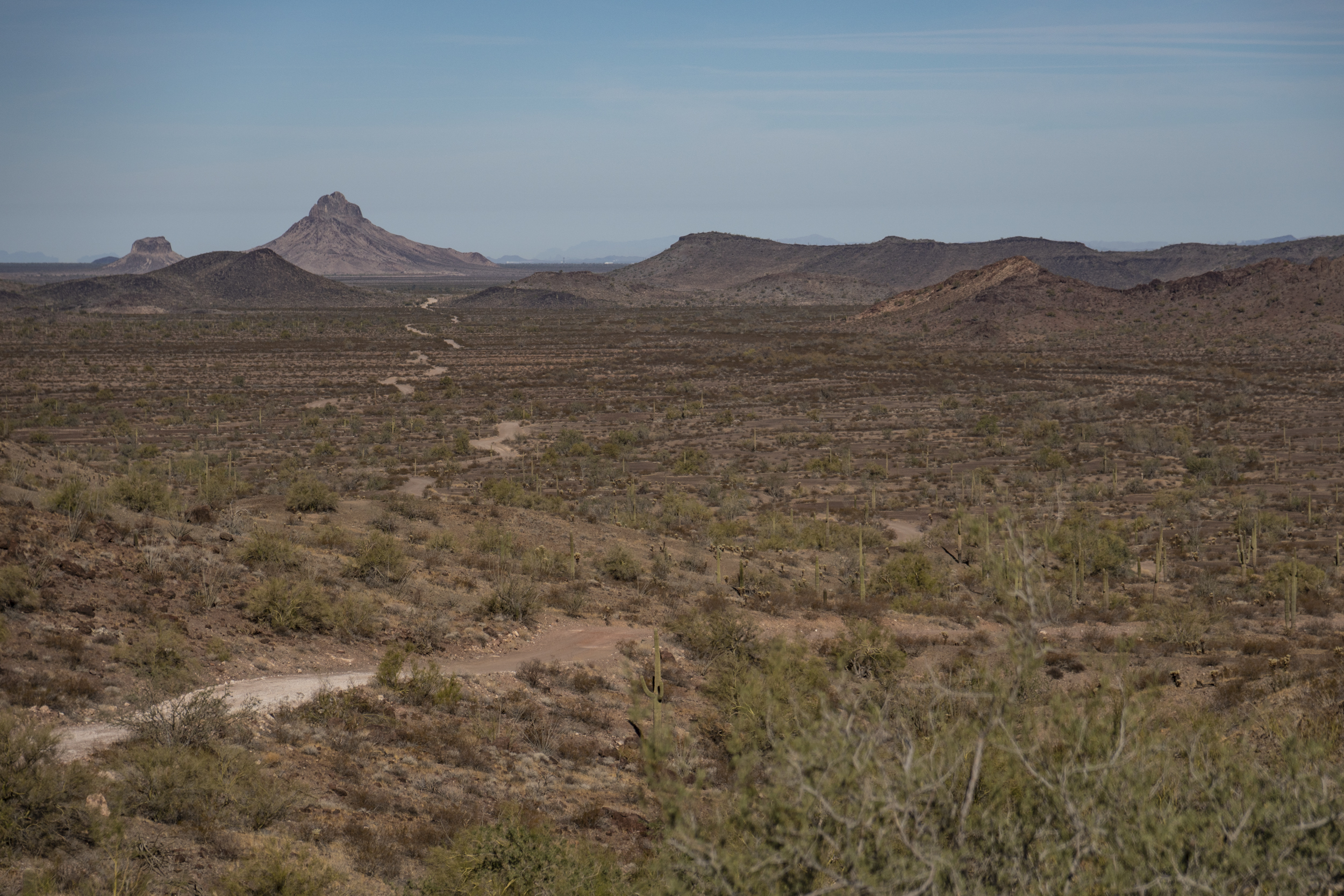
This delightful desert tour through the Kofa National Wildlife Refuge is on 100% dirt, 100% public lands, and through stunning mountains. This winter route is entirely on roads, but most are unimproved 4×4 roads that can be rocky or soft, so a mountain bike with 2.4-2.8″ tires is highly recommended. There are plenty of loose, chunky 2-tracks on this route, and smooth “gravel” is the exception rather than the rule. In most of the Refuge, ATV use and vehicle traffic in general is minimal, so expect a quiet experience. On the maps below, red sections of the route are unimproved 4×4 roads, the pink are “improved” roads, and blue are Wilderness trails where bikes are not permitted. And if you look at older topo maps of the area, keep in mind that many of the 4×4 road “connections” through the mountains are now in Wilderness and are closed to bikes and vehicles alike.
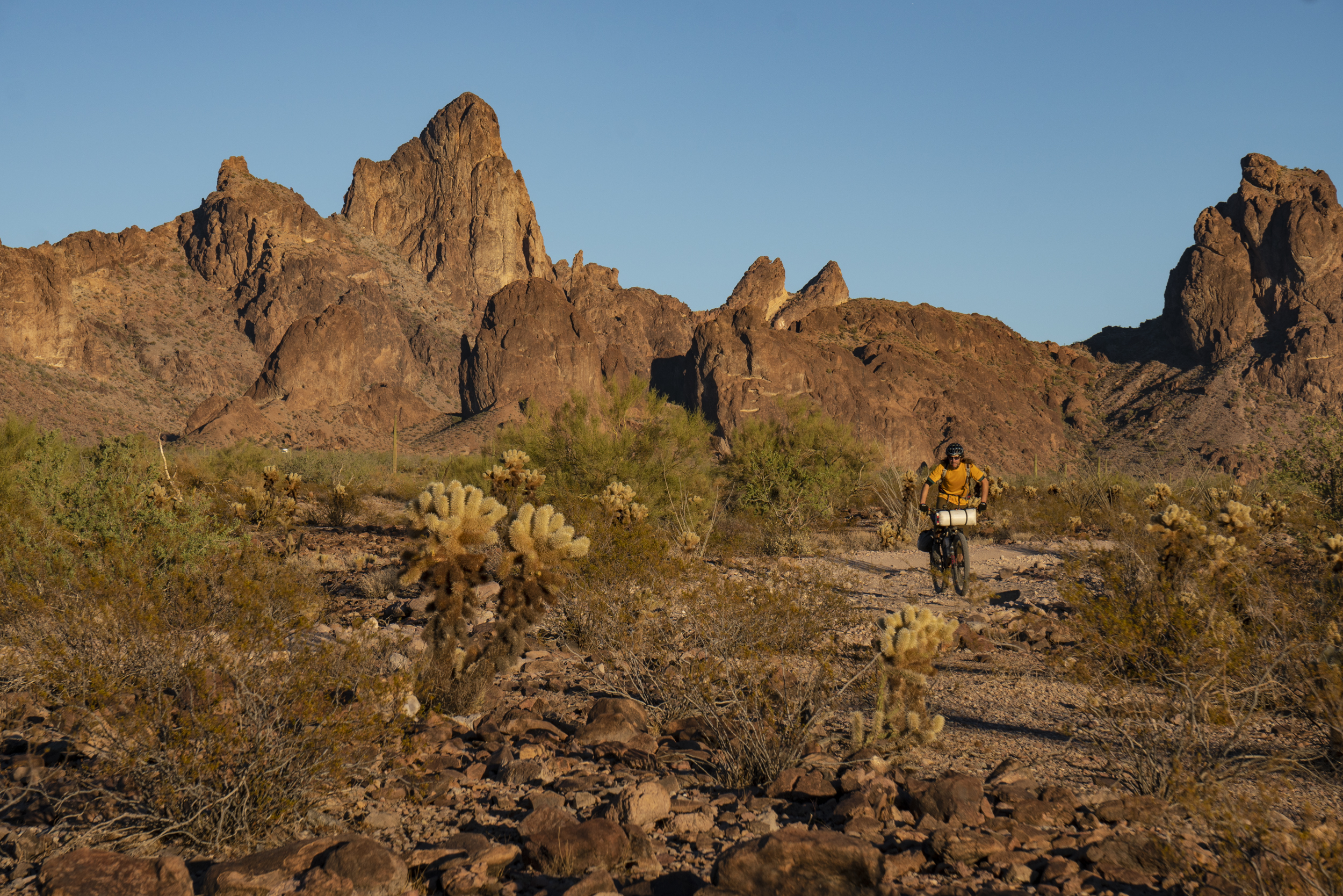
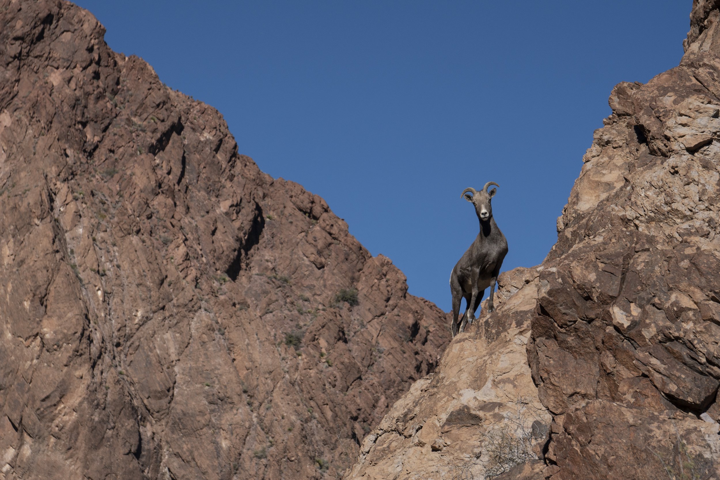
Included here are “long” and “short” versions of this loop. The long one includes some side hikes/scrambles and a slightly longer route to the northeast; the short one skips the side hikes and takes the most direct route through the monument. Recommended peaks to climb along the way include Signal Peak (a steep hike) and Castle Dome (a steep hike with some exposed scrambling near the top). Both trails are mostly well-marked with cairns. Ten Ewe, adjacent to Signal Peak, offers another option. All these peaks have spectacular views, but Signal takes the cake for the most impressive – sunrise or sunset from the summit would be unforgettable. A short hike up the popular trail into Palm Canyon offers a neat opportunity to see Arizona’s only native palms. And on any of these hikes in the mountains, keep your eye out for desert bighorn sheep – ~500 live in the refuge, and the refuge was originally established to help the dwindling sheep population recover after being outcompeted for forage and water by cattle brought into the area by ranchers. Today, the bighorn population here is healthy, and individuals are captured and moved elsewhere in the Southwest.
Water sources included here are generally reliable – they’re a mix of deep bedrock pools (“tanks”) and constructed wildlife water sources. These have long been used by backpackers and NOLS wilderness courses, but do not take water from any tanks that are low. Less reliable water sources are not included here in an effort to not have a negative impact on those. And as should always be the practice in the desert, never count 100% on any single water source!
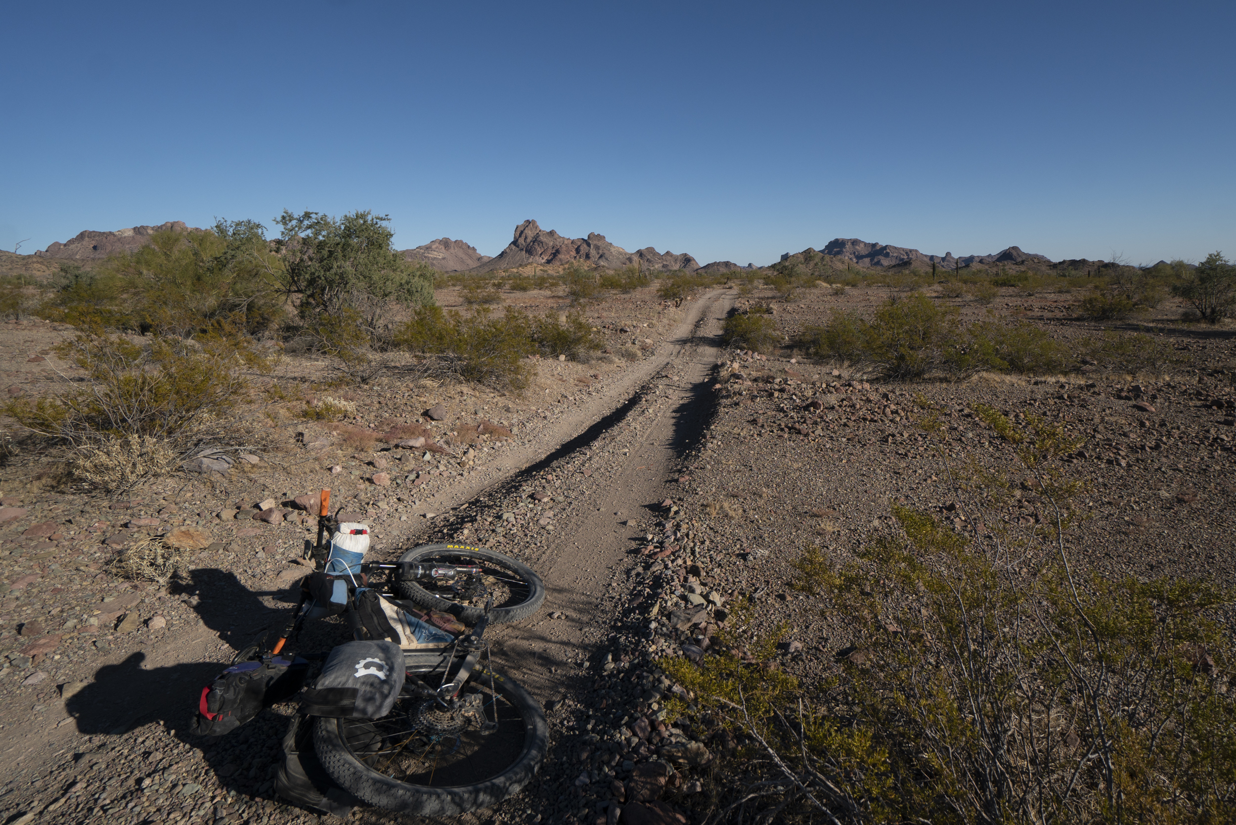
The loop can obviously be started anywhere and ridden in either direction, but good spots to park and roll out can be found on the northern and western sides (the western is the most visited part of the Refuge, and the recommended parking spot is adjacent to where a “site host” is often set up in an RV. From that western side, riders can easily access (perhaps initially without bikepacking gear) the Palm Canyon trailhead up a main dirt road or hop north to the next canyon to reach the base of Signal Peak to hike up that. The “road” up to the trailhead turns into a gravelly wash up a beautiful canyon. Then heading south/counterclockwise on the loop from this area (perhaps swinging back by a vehicle to pick up gear and more water?), some remarkably smooth gas line 2-track leads to King Road, a wide gravel road that leads into the heart of the Refuge. Both the long and short versions turn south off King Road and onto a 2-track toward Little White Tanks. The long version has a spur south over a rougher 4×4 road over McPherson Pass to reach the access to the Castle Dome Peak hike. Little White Tanks are a series of deep bedrock pools with reliable water. The routes then rejoin King Road, conditions get a bit softer in places, and past the King of Arizona (KOFA) Mine, the road deteriorates into a 4×4 track. There’s a few miles of wash riding, some rutted and rocky sections over Engesser Pass, and the area steadily becomes more remote and beautiful.
The east side of the loop is the roughest and slowest on 4×4 tracks that climb in and out of numerous drainages. At Hoodoo Cabin and well, the long route turns east into the Little Horn Mountains. The first miles of this are the roughest of the entire loop through jagged little mountains (and leaves the Refuge), and then as the route hits the northern side of these mountains, the route joins a wide, bladed road and the riding becomes much faster. The shorter loop takes a more direct route on continued 4×4 track past Craven Well.
The northern side of the loop is a mix of rough dirt road, a little cobbly wash riding, and rolling 4×4 tracks. Near Kofa Cabin, the New Water Well is a reliable water source, and farther on, High Tank Six is a deep bedrock pool above the road that reliably holds water. West of High Tank Six, the route eventually joins a wide gravel road before turning south onto a mellow gas line road that parallels the busy Highway 95.
- Paved: 0%
- Smooth Gravel: 20%
- Rough Gravel: 25%
- 4×4 Road: 55%
- Singletrack: 0%
See the “Additional Route Information” section of the route website for more information on water, camping, public lands, safety considerations and more.
- This route is part of a collection of routes on the Backcountry-MTB website. Please see more details on the route webpage.
- Please find both versions of the route on Ride with GPS:
Kurt Refsnider created and stewards this route.
Kurt is Bikepacking Roots’ Routes Director and co-founder. He’s dedicated years to developing bikepacking routes and guides for other riders including the Western Wildlands Route, the Bears Ears Loops, the Northwoods Route, and many shorter routes. His passion is riding in wild, remote landscapes, and many of his route visions aim to help others experience places, connect to those landscapes, and recognize why the conservation of such places is so important.
Please get in touch with any updates on route conditions that may be relevant to other riders.
Unfortunately, Kurt is not available to help folks with trip planning questions.
Please submit your questions and comments on the route to Kurt through the comment form below.
This route traverses the traditional lands of the Yavapai Apache, Cocopah, and Quecahn.