Route Overview
Region
Miles
Days Out
Recommended Tire Size
Season
ice cream stands are only open Summer months
Elevation Gain
Difficulty
3/10 Technical
Primary Surface(s)
Smooth Gravel
Route Map
Route Details
Mud Pie ups the ante of the Sundaes Fundays overnighters with over 50% of the route unpaved. Not bad for a route in Boston’s backyard.
After hopping aboard the MBTA Commuter Rail in Boston, riders are whisked back in time to where the first shots of the American Revolution were fired, Concord, MA. The route winds its way through small communities steeped in history, a National Park, and numerous ‘town forests’ while enjoying well-timed stops at the region’s unique dairy bars. Riders will take on the historic ‘Battle Road’ in Minute Man National Historical Park, ride through the cradle of the American Industrial Revolution, and pay a visit to some of our literary greats using stretches of oft-forgotten footpaths and well paved rail trail.
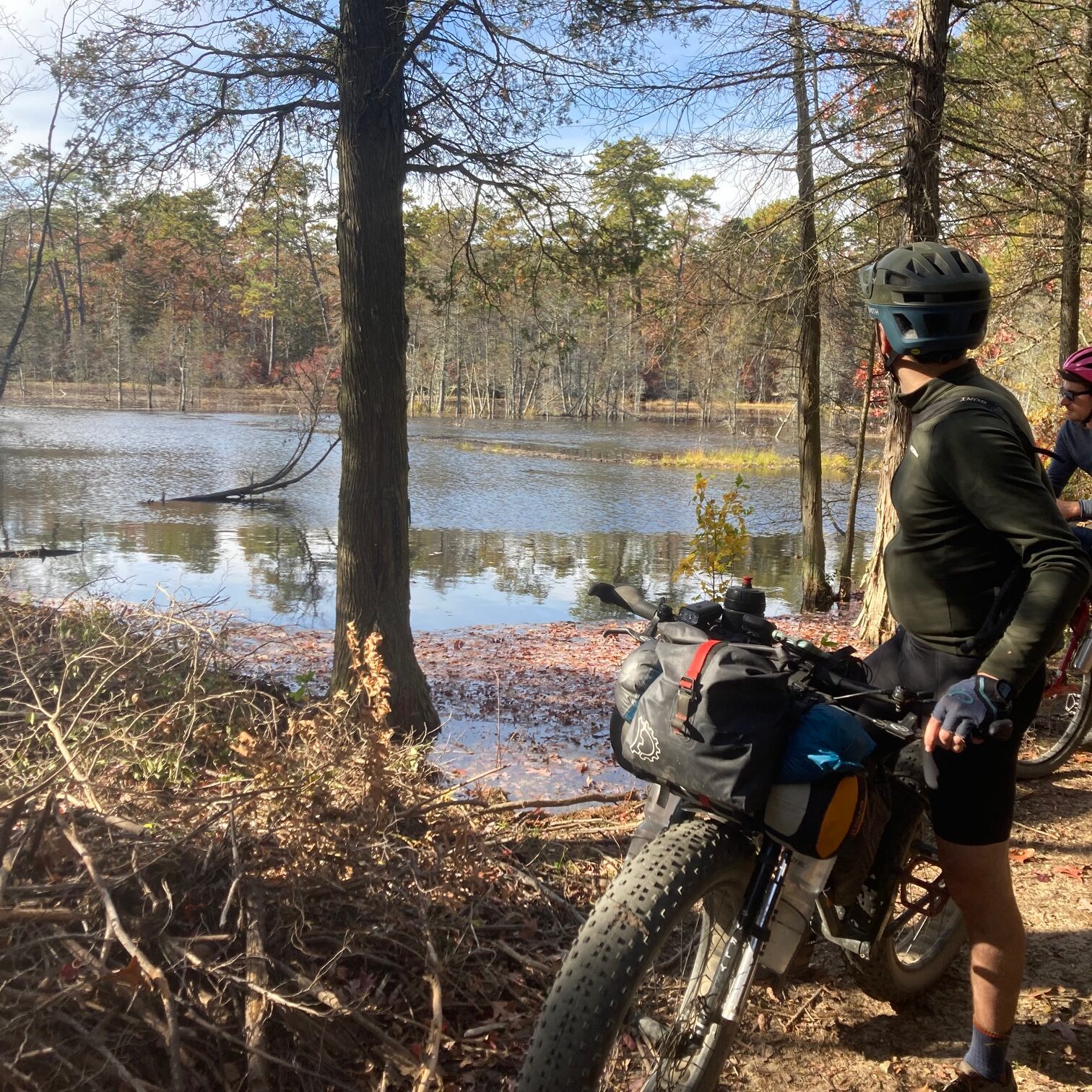
While the overall technical difficulty and route difficulty are rated quite low due to the significant amount of smooth riding and pavement. Some sections are lightly trodden and others well-worn to ruts and roots. For inexperienced riders to keep a good attitude, the rough sections are never long, and ice cream is never far away.
What is a dairy bar? “The dairy bars of Massachusetts are a state treasure. On city outskirts or amid rolling hills, they open as the weather warms, make their ice cream often on-premises, and look and operate much as they have done for years. These are places people visit as children with parents and grandparents, then introduce to their kids and grandkids. Many dairy bars date back a century or more, with some still attached to working dairies that deliver milk in glass bottles. As condos take the place of cows, these old-school ice cream stands serve as reminders of a time when dairy farming thrived in the region.”
Mud Pie is the second in a series of ‘Sundaes Fundays’ bikepacking overnighters in Eastern Massachusetts. These routes emphasize accessibility from Boston via public transit and ice cream!
The route’s designated start and end point is in historic Concord, MA, where the Concord MBTA Commuter Rail Station provides an easy jumping-off point for exploring the Greater Merrimack Valley. Pedaling out of Concord, riders immediately find themselves on the Reformatory Branch Trail, an unpaved extension of the Minute Man bike path. The path parallels the Great Meadows NWR on the North, and Sleepy Hollow Cemetery, containing family plots of the famous authors Nathaniel Hawthorne, Ralph Waldo Emerson, and Henry David Thoreau among other historically notable persons.
Heading north from the Reformatory Branch Trail, the route brings riders through residential streets where sharp-eyed riders might spot the 6′ tall bottle of Heinz Tomato Ketchup. Continuing north, riders enter the first stretch of true singletrack. The entrance can be hard to spot through all the ferns. Don’t worry, just a couple-hundred yards in, the trail opens up considerably. At Carlisle Road, riders can detour to the east for a just-out-of-the-way stop at Bedford Farms Ice Cream before rejoining the route in Huckins Farms. If you get a late start, Dudley Park allows camping with a permit (use the permit linked to in the camping POI, or at the bottom of this description). If you don’t stop at Dudley Park, continue across the Concord River and into Great Brook Farm State Park. The Park abuts its namesake Farm, where the on-route Dairy Bar appears nestled behind a small hill surrounded by dairy cows.
At mile 20 riders join the Bruce Freeman Rail Trail, taking it to Chelmsford. Here, the route attempts to bypass Lowell, the 5th largest city in MA as possible, which results in an unfortunate zigzag through residential streets. Keep alert as traffic may be heavier in these areas. Crossing the Merrimack River quickly provides a respite from the traffic as the route hops back on singletrack through Lowell-Dravut-Tyngsborough State Forest. Here riders’ legs will be tested- a climb up Whortleberry Hill tops out at 290 feet, the second-highest point on the route!
Approximately a third of the way through, the route hops into New Hampshire for a few miles of singletrack that is often overgrown. Returning to Massachusetts north of Methuen, riders can stop at Forest Lake for a swim before continuing down the Methuen/Salem Rail Trail. Unfortunately, there is no way around Methuen and Lawrence, so riders should take this opportunity to resupply if necessary. Once the route leaves Andover, opportunities to stop for resupply dwindle as riders pass through a series of reservations, conservation areas, and forests. Stop at Boston Hill Ice Cream for a final treat before hitting camp at Lorraine Campground in Harold Parker State Forest (mile 70). There is swimming at Frye Beach as well.
Day 2 (or 3 if you stop at Dudley Park) starts with forested trails in Harold Parker State Forest, followed by a stretch on the Independence Greenway Rail Trail. As the route begins to turn back west, the car-free riding through Lynn Woods, Breakheart, and Middlesex Fells Reservations provides some of the most enjoyable sections of the entire route. Explore the stone tower in Lynn Woods, swim at the beach in Breakheart, and rip the trails through Middlesex. You might be tempted to skip the steep climb up Horn Pond Mountain, but the view of the Boston skyline from the top is worth the effort.
Finally, ride to the finish along the historic ‘Battle Road’ in Minute Man National Historic Park, where thousands of Colonial Militia and British Regulars fought a bloody engagement on April 19, 1775. If you still aren’t satisfied, detour at mile 129 down Walden St. to Walden Pond for a final refreshing dip.
- Paved: 50%
- Smooth Gravel: 20%
- Rough Gravel: 5%
- 4×4 Road: 5%
- Singletrack: 20%
Can I ride this route on my gravel bike? Sure. Sitting at 50% paved riding surfaces, this route is decidedly gravel bike-friendly. However, the singletrack sections will have you cursing that decision. The route has significant sections of East Coast singletrack so expect rocky, rooty, potentially steep, and boggy. But don’t let that deter the use of a gravel bike. A minimum tire size of 40mm is advised; a bike with front suspension and 2.0″-2.3″ tires is suggested. Routes were scouted on gravel bikes with 45-50mm file tread tires, and the creators enjoy underbiking.
Getting here: The route is completely accessible via several Massachusetts Bay Transit Authority (MBTA) commuter rail stations (noted on the map) from downtown Boston, MA. The commuter rail allows bikes on every train except during peak commuter hours on weekday mornings, has cheap weekend pricing, and runs late into the evenings. The designated start and end point of Mud Pie is accessible via the Concord Station on the ‘Fitchburg’ line from North Station. North Station is also an Amtrak terminal and accessible from Boston Logan International Airport. Alternate starting locations accessible from various commuter rail lines are Lowell Station, Lawrence Station, Andover Station, Ballardvale Station, Melrose Highlands Station, or Winchester Station. For more information, visit the MBTA website: mbta.com/schedules/commuter-rail
Camping: Suggested camping locations on the Mud Pie route are Dudley Park, 10 miles into the route (perfect for a Friday afternoon start), and Lorraine State Park Campground in Harold Parker State Forest, mile 70. Camp Nihan Education Center in the Breakheart Reservation, mile 95 is also a possibility. In all cases make reservations beforehand using the permits and links at the bottom of the page, but keep in mind that under MA DCR policy, they shouldn’t turn you away at Lorraine Campground or Camp Nihan, even if they are full. Finding public camping in MA is difficult. Unless explicitly allowed, there is a blanket ban on dispersed camping on State land and most other public land. There are numerous private campgrounds that cyclists can take advantage of. The suburban nature of this collection also means plenty of non-camping accommodations available on/off route including hotels, BnBs, AirBnB, and others. Some suggestions have been marked on the map.
Food/Resupply: The suburban nature of the route means resupply points are plentiful. Some have been marked on the map, but riders are never more than a few miles from a town with groceries and food stops. In addition, make use of the many farm stands along the route to buy farm fresh produce! Many of the Ice cream stands also have some food options.
- Dudley Park Camp Permit: town.billerica.ma.us/DocumentCenter/View/2119/Great-Meadows-and-Dudley-Park
- Camp Lorraine/Harold Parker State Park Camping: massdcrcamping.reserveamerica.com/camping/harold-parker-state-forest/r/campgroundDetails.do?contractCode=MA&parkId=32608
- Commuter Rail schedule and passes: mbta.com/schedules/commuter-rail
- Massachusetts DCR ‘No Turn Away’ Policy: adventurecycling.org/wp-content/uploads/2023/08/MassParks-No-Turn-Away-policy.pdf
- Ketchup Monument: thebedfordcitizen.org/2016/09/six-foot-sculpture-is-the-ketchup-lovers-size
William Kessler created and stewards this route. Here is a little about William in his own words:
“I’m a Geographer by training, with a passion for all kinds of recreation on public lands. I’m a big fan of under-biking and love finding out whether or not a proposed route “will go” the hard way. My interests in maps and bikes means I’m constantly pouring over new areas, devising trips for some day down the road. My first bike touring experience was in 2017 on a self-devised route multi-month tour through Colombia and Ecuador. Since then, I’ve taken every opportunity to get out and ride somewhere new. In 2022, after several years living in Helena, MT and watching divide riders pass through town, my partner and I toured the route before ending up in Cambridge, MA. Now we’re having fun exploring the class 4 roads of New England! “
William has offered to be available to answer questions if you are planning a trip on this route. Please also get in touch with any updates on route conditions that may be relevant to other riders.
Please submit your questions and comments on the route via the contact form below.
- This route traverses the traditional lands of the Wabanaki (Dawnland Confederacy), Abenaki / Abénaquis, Pawtucket, Pentucket, Pennacook, and Massa-adchu-es-et (Massachusett)


