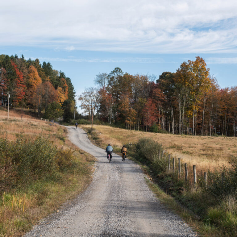
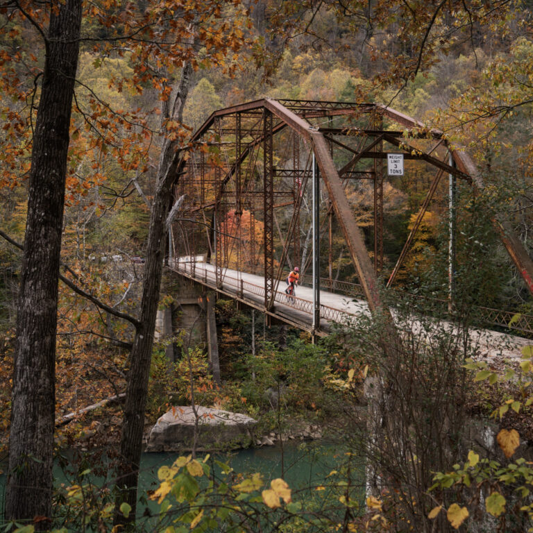
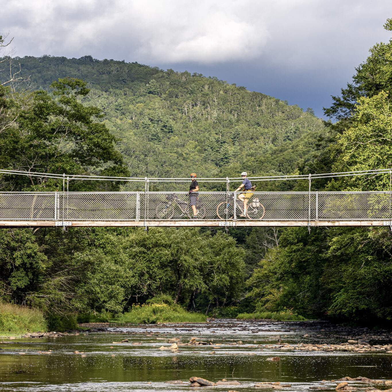
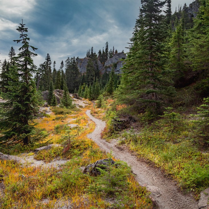
The Mountaineer Monster bikepacking routes offer a challenging, yet rewarding, tour of the Mountaineer Country region of West Virginia, routing through the highlights of Monongalia, Preston, Barbour, and Taylor Counties. If you are brave enough to ride amongst the cryptids of local lore, you’ll find countless swimming holes, breathtaking vistas, and the welcoming people of the region. The routes favor the less-frequented gravel roads of the region, many of which are chunky, rutted, and unimproved for years. 

The beauty of the Mountaineer Monster lies in its challenge—plenty of climbing, beautiful forests, and undiscovered places to enjoy and overcome.

West Virginia has a deep history of local folklore, especially when it comes to cryptids – a creature that hasn’t been proven to exist, but extensive stories and sightings might convince you otherwise. You’ve probably heard of the big ones – Mothman, Bigfoot, Snallygaster – but West Virginia is home to countless more. To celebrate this heritage, riders will have the option to participate in the Cryptid Scavenger Hunt. These sites are marked on the Ride with GPS routes using the Geocache POI .

The Mountaineer Monster is built upon Mountaineer Gravel, the gravel route network designed by David Landis / V2V Trails for Visit Mountaineer Country

Mountaineer Country is the heart of North-Central West Virginia. Well-known for outdoor adventure and Appalachian culture, this land is rooted in tradition and pulsing with energy!

After three years of development and thousands of miles of gravel roads ridden and explored in the region, Mountaineer Gravel now offers more than 40 unique gravel routes departing from 10 regional hubs, offering more than 1,500 miles of riding. Three easy routes use only rail trails, and the rest all have significant climbing, generally 1,000 feet per ten miles. Most rides span a few hours to a full day, but a number work well as overnight experiences offering lodging and camping. 

General Information and Logistics

  • Three bikepacking route options: 110, 275, and 465 miles, allowing riders to choose an adventure that matches their experience and available time.
  • Cryptid scavenger hunt offering a way for bikepackers to dive deeper into local folklore and legends.
  • Purpose-built for bikepacking, connecting the best gravel roads, 4×4 tracks, rail trails, and rural communities across north-central West Virginia.
  • Regular opportunities for resupply, restaurants, lodging, and camping in welcoming small towns.
  • Historic West Virginia towns including places like Terra Alta, Belington, Philippi, Grafton, Newburg, Rowlesburg, Albright, Bruceton Mills, Kingwood, Masontown, and Morgantown, each offering its own character and hospitality.
  • Spectacular scenery throughout the region’s rolling hills and rivers, including overlooks, scenic farmland, waterfalls, swamps and deep forests.
  • Visit a variety of state and county parks including Chestnut Ridge, Coopers Rock, Audra, Tygart Lake, Bunner’s RIdge and the Deckers Creek and Mon River rail trails.
  • Rich Appalachian history featuring railroad heritage, Civil War sites, coal history, epic bridges, and historic downtowns woven into the routes.
  • Annual October Grand Depart presents a personal race challenge or a social touring adventure.

The best months to ride are April through October, with spring and fall days having colder temperatures overnight and even the possibility of snow at higher elevations. Spring colors usually peak in late April, and fall foliage in October. Summer months bring warm weather, though much of the route is shaded and benefits from the cooler temperatures at higher elevations, especially on the eastern edge of Preston County.

An adventure bikepacking bike or hardtail mountain bike with 2” or wider tires is recommended for these routes. While you can certainly ride this route on a rigid gravel bike with skinnier tires, and many will—wider tires, front suspension, and mountain bike geometry may make for a more comfortable and pleasurable experience. The longer the route, the more you’ll appreciate the extra cushion.

Tires: 45-50mm / 2” minimum width recommended, with knobby tread on sides and center. Most gravel roads are in good shape, but there are a few mostly used by ATVs that are loose, rutted, washed out, and have embedded rocks in the road surface.

Gearing: Low gearing is a major factor to prioritize on this route. Most gravel bikes are not geared low enough for loaded bikepacking on a route as hilly and steep as this (but are likely fine for strong riders not carrying multi-day equipment). A minimum gearing ratio of 1:1.2 is recommended (smallest chainring to largest cassette cog). Many riders prefer a 1:1.5 ratio for lower gearing while bikepacking.

Brakes: High-performing and well-maintained brakes are a must. It is highly recommended to start the route with new brake pads and to bring a full spare set. Disc brakes will stop faster in wet conditions than rim brakes.

Equipment capacity: It is recommended that riders can carry enough food for 50+ miles, as well as 2-3 liters of water (more in hotter weather)

Spares/tools: Riders should be prepared and carry all necessary tools and spares to repair mechanical issues. There are bike shops in Morgantown directly on the route only. Carry any spare parts that are unique to your bicycle (brake pads, derailleur hanger, proprietary parts, etc.)

A variety of overnight options exist along the Mountaineer Monster routes: state park camping, private campgrounds, Airbnbs, hotel chains, local inns, and bed & breakfasts. Many (certainly not all!) of these options are listed on- and off-route as POIs in the RWGPS file. 

Do not camp on private property. Wild camping is not permitted in Wildlife Management Areas or state parks (unlike National Forests). Use established campsites and be mindful of online booking systems and reservations; often, it is the best bet to call or reserve ahead of time, as there may be limited options the night of. Remember this route is quite challenging and may take longer than anticipated. Be realistic about your capabilities when making reservations and planning your accommodation timeline.

Routes in this network are not marked on the ground and do not include any on-route signage; navigation is entirely self-guided using GPS tracks.

All routes are hosted in the Mountaineer Monster Ride with GPS (RWGPS) collection and include:

  • Detailed navigation
  • Elevation profiles
  • Points of interest (POIs)
  • Water sources
  • Camping locations
  • Town services such as shops, restaurants, and outfitters

Join & Follow Mountaineer Gravel on Ride with GPS and pin these routes to your personal account. Ride with GPS will notify you if there are any route changes or updates. By becoming a Mountaineer Gravel RWGPS member, you can also download the routes offline for free in the mobile app.

To navigate, riders can either download GPX files or sync routes to GPS units or use the Ride with GPS mobile app for offline navigation. If navigating on a phone, expect increased battery usage.

The routes pass through remote areas with limited resupply, so riders should be prepared to treat natural water sources.

Recommended options include:

  • Water filters
  • Chemical purification
  • Boiling water when camping

Surface water sources shown on route maps are generally reliable, but conditions vary seasonally. During dry periods some sources may disappear, while wet seasons may create additional streams.

Outdoor water spigots and campground pumps may be seasonally shut off and unavailable during colder months.

Riders need to be mindful of multiple safety concerns, and riders should do their best to lessen their part in the risk of common riding hazards. 

The routes prioritize rural and unpaved roads, but by necessity, will occasionally put riders (briefly) on higher traffic and higher speed roads. At all times, riders should seek to remain as visible as possible to traffic. Please wear bright and visible clothing, take care on blind curves, and stay aware and alert to your surroundings and the traffic and riders around you. It is advisable to use a flashing taillight (certainly at twilight and night!), during weather that limits visibility, and generally, as most of the route is shared with motor vehicles.

The routes feature a variety of road surfaces, and it is important to stay alert and cognizant of changing road conditions (especially in rain). Unpaved surfaces can be unpredictable in terms of cornering, depth, and thickness of gravel, etc. 

There are many steep downhill sections with grades between 15-20%. On a loaded bikepacking setup, it is easy to reach significant speeds quickly. Make sure that your brakes are in reliable working order. It is strongly recommended that you ensure your brakes are serviced with new brake pads before the trip, and that you have spares with you on the route, even new brake pads can be worn down throughout the route, considering the steep roads; potentially wet conditions would compound this reality.

There is not consistent and reliable mobile phone coverage on the routes. There will be significant stretches with no cell service at all. Consider carrying a satellite tracking device with SOS and texting capabilities. 

The routes traverse forested areas that are well-populated with deer and wildlife. Early in the morning and twilight, be especially aware of startled deer that may run across the road close to you as you ride. If you are camping on the route, practice bear safety: hanging food and scented items, and keeping food out of your tent. Be mindful of not attracting other nuisance animals to your campsite (raccoons, skunks, etc.) that will be attracted by food left out. 

Along the routes, it is possible that you may encounter aggressive and unleashed dogs. The best way to avoid an incident is to stop, dismount, and put the bicycle between yourself and the dog. Usually, the dog will stop chasing when you stop riding and will come out to ensure you aren’t a threat. 

All routes are mapped to start and end in Chestnut Ridge Park, located at 321 Chestnut Ridge Camp Rd, Bruceton Mills, WV 26525. Multi-day parking is available, please coordinate with the park at 304-594-1773.

There are several ways to follow along and connect with other riders for the Mountaineer Monster routes or other adventures in Mountaineer Country. 

Instagram @mountaineergravel 

Facebook Group: facebook.com/groups/1146075576860879 

Facebook Event: facebook.com/events/612031198358864 

Strava Club: strava.com/clubs/mountaineergravel

An annual Grand Depart of riders on the three Mountaineer Monster routes started in 2025. Information on the 2026 Grand Depart, which starts October 24th, can be found here

Check out a video recap of the 2025 Mountaineer Monster Grand Depart.

We are highlighting the three Mountaineer Monster routes as Signature Bikepacking Routes, but there is much more to explore in the Mountaineer Gravel Route Network, including several other routes that would be great for overnight trips.

You can find more information on the Mountaineer Gravel website or the Mountaineer Gravel Ride with GPS page. The overnighter collection on Ride with GPS includes nine routes from 30 – 75 miles that have camping or lodging options along the way.

Route network design and content publication by David Landis of V2V Trails.

Special thanks to the Visit Mountaineer Country team for supporting and promoting this gravel route development project! And to local & regional riders for route suggestions, feedback and inspiration, especially AJ Delauder, Alden Roth, Andrew Walker, Andy Williamson, Chuck Morris, Corey Lilly, Ethan Flanigan, Jacob Rex, Jason Martin, Jennifer Walker, Joanna Friesen, JR Petsko, Kayla Hall, Katie Wolpert, Larry Paris, Mike Miller, Nathan Fetty, Nick Morales, Rachelle Thorne, Thad Kelley, and Travis Olson.

If you have any questions or feedback on the route network, please reach out via the contact form below.

    All Routes

    Mountaineer Monster 110


    Region: West Virginia

    Season: April – October

    Miles: 110  |   Elevation: 10,500’

    Days Out: 2-3  |  Tire Size: 45mm+

    Difficulty: 6/10 Physical   |  4/10 Technical


    Ride the highlights of the Mountaineer Gravel network in this 2-3 day adventure in north-central West Virginia. Expect a little bit of everything with some challenging terrain through farmland, forests, across rivers and tall bridges, and the region’s best rail trails before the final climb back up.

    Mountaineer Monster 275


    Region: West Virginia

    Season: April – October

    Miles: 275  |   Elevation: 28,000’

    Days Out: 3-6  |  Tire Size: 2″+

    Difficulty: 7/10 Physical   |  5/10 Technical


    Bikepack the unpaved rugged highlights of the northern Mountaineer Country to visit farmland, breweries, rivers & creeks, and cryptid folklore. Expect rugged and spicy gravel & primitive roads, small historic towns, and all the climbing and adventure north-central WV can provide!

    Mountaineer Monster 465


    Region: West Virginia

    Season: April – October

    Miles: 465  |   Elevation: 48,000’

    Days Out: 4-8  |  Tire Size: 2″+

    Difficulty: 7/10 Physical   |  5/10 Technical


    This epic bikepacking sojourn takes you on a grand tour off the beaten path across all the quirky sites of north-central West Virginia’s Mountaineer Country region. Spanning four counties and numerous rivers, rugged forgotten tracks, and cryptid folklore, this route is not for the faint of heart or fitness— its challenge is worth the reward.

    Land Acknowledgement

    We acknowledge that the lands these routes traverse are the ancestral homelands of Indigenous peoples, including the Shawnee, Massawomeck, and Osage, who stewarded these mountains and rivers for generations. We honor their enduring connection to this land and recognize that their histories and cultures continue today, and we offer this acknowledgment with respect and gratitude.

    This project was made possible with support from our partners at: