Segment Overview
Route Creator
Miles
Days Out
Recommended Tire Size
Season
(avoid summer at all costs)
Elevation Gain
Difficulty
4/10 Technical
Primary Surface(s)
Paved
Route Map
Route Details
The Texas segment of the Great Plains Gravel Route is bookended by two iconic environments: the Texas Big Bend in the south, and the Llano Estacado and Southern High Plains in the north. Big Bend country is large, mysterious, and well-known in the adventure travel and mountain biking arenas. The Llano Estacado, stood up by the Caprock Escarpment, is infamously flat, windy, and home to a great deal of plains indigenous and pioneer history. The history of the Southern High Plains in the Texas Panhandle and the Llano Estacado is not to be ignored. Once a sea of grass ruled by the Comanche, the area smacks of self-sufficiency, grit, and the determination it took, and still takes, to scratch a livelihood out of the ground there.
In between these regions lie the Permian Basin, the heart of U.S. oil production, and the transition zone between the Texas Hill Country and the Trans-Pecos Region. The route traverses lesser-known areas of the state compared to its more popular and populous areas to the east. It routes people through the heart of some of the nation’s most changed lands, most involved agriculture, intense energy production, and, at the same time, some of the nation’s least impacted land and most rugged desert environments. The route presents a chance to intimately engage with the origin source of much of what makes our nation move – wheat, cotton, beef, and oil.
At the same time, riders will encounter hospitable and curious people and population centers built around notable and iconic histories. This route is also made for riders looking for a challenge–a challenge in riding conditions, in weather conditions, and in challenges that only riding on long, lonesome stretches of farm and desert roads can invite.
Riders will especially consider the following as highlights worth looking into more before or while on the route:
1. Presidio, Texas
2. Big Bend Ranch State Park
3. Marfa, Alpine, Marathon, and Sanderson, Texas
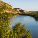
4. The Pecos River
5. Fort McKavett
6. The Caverns of Sonora
7. Eden, Texas
8. The Painted Rocks Native American Pictographs near Paint Rock, Texas
9. Lake Colorado City State Park
10. The Caprock Escarpment
11. Ransom Canyon near Slaton, Texas
12. Brazos River
13. Lubbock, Texas
14. Lubbock Lake Landmark
15. Playa Lakes
16. Llano Estacado
17. Quanah Parker and Charles Goodnight
18. Caprock Canyons State Park
19. Palo Duro Canyon
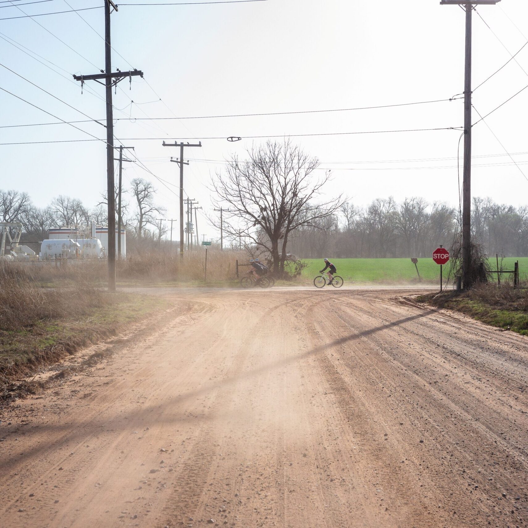
Welcome to The Rio to the Llano route! This 1,150-mile-long cycling route introduces riders to the most iconic Texas plains environments and then some, including not only the famed Llano Estacado, but also the Permian Basin, and the Texas Big Bend. The route crosses through a large and diverse landscape, from the grassy ranchlands of the Texas Panhandle to the flat cotton and wheat farms of the Llano Estacado, through the rolling, rocky country that defines the Edwards Plateau as it transitions to the Trans-Pecos region, to the rugged desert near the Texas/Mexico border. The ideal time to ride The Rio to The Llano is mid- to late-spring or mid- to late-fall. Given the heat and wind, as well as the Big Bend monsoon season, it’s best to avoid summer altogether. Although the route is not technically challenging, road conditions range from hard-pack caliche to deep sand, the latter affecting ride times and morale. Likewise, this route includes several long stretches between services or population centers worth preparing adequately for in training and packing.
The prevailing winds are largely from the south, so let’s start on the Texas/Mexico border in Presidio and gradually climb along the route toward the Llano Estacado. With just a few miles of pavement to start off, the route quickly turns north along Casa Piedra Road, a classic Big Bend road comprised of chunky caliche, deep draws impassable after a rainstorm, and unmarked diverging gravel roads. Stay on the route here to avoid getting lost. The route moves north to Marfa, and then east along the paved Route 90 utilized by Adventure Cycling’s Southern Tier Route, through the small Trans-Pecos cities of Alpine, Marathon, and Sanderson, eventually passing through the ghost towns of Dryden and Langtry before turning north again on gravel headed to the Pecos River. The land in this region is parched, so planning your water accordingly is key.
The stretch between Pandale and Ozona, and then from Ozona to Sonora are quiet and likely without much human interaction. Quick hard-pack caliche connected by single- and two-lane chipseal makes up most of this region’s road conditions, and the rolling land turns to mesquite and juniper trees (called cedars in this area), cattle and sheep pastures, and oil infrastructure. The big push from Sonora to Eden passes through historic Fort McKavett, still a lonely outpost of a community on the edge of the Texas Hill Country.
Gravel and sections of pavement make up the route as it meanders north through the western Edwards Plateau, hitting small towns without much in the way of lodging or camping. High-fenced game ranches and low-fenced cattle, sheep and goat operations make up most of the area’s rural environment, the ground too rocky for mass cultivation. The route was designed to largely skirt the Permian Basin, where traffic is heavy and gravel roads terminate at pumpjacks. Lake Colorado City State Park offers a quiet respite from the industry around it, and Big Spring is a good place to rest up before pushing north onto the Southern High Plains.
Sandy soils make for sandy roads as one rides north from Big Spring, and although a road may be marked impassable due to seasonal winds, an alternative is easily found since the cotton farms that make this region distinct are laid out in a grid. You’ll begin to pass center-pivot irrigation systems on your way to Lamesa, one of the suspected origin places of the chicken-fried steak. You’re now in the largest cotton patch in the nation, and it shows all the way to Lubbock, the largest city on the route at close to 300,000. Situated right on the edge of the Caprock Escarpment, Lubbock is built around one of the several forks of the emerging Brazos River. Have your bike checked out at Velocity Bike Shop, take it easy for a day, and prepare to head north toward ranch country.
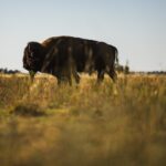
Leaving Lubbock, the route passes through more cotton production before jumping off the Cap (the Caprock Escarpment, that is) along the best rails-to-trails system in the state, the Caprock Canyons State Park Trailway. Camp along the old railbed just outside of Clarity Tunnel or lay your head down among the gypsum-rich canyon walls that make up the state park’s interior just north of Quitaque. Home to the Texas State Bison Herd, Caprock Canyons is an apt launching-off point for the longest day in the saddle. At 78 miles to the next water, and another 25 to the next place where lodging or camping is possible, the ride through the historic JA Ranch is scenic, lonesome, and a bit daunting, punctuated by a steep climb back up on the Llano Estacado along a section called Koogle’s Jump-Off. You’ll water up in Goodnight, named after legendary lawman, rancher and conservationist Charles Goodnight, before pushing on to Clarendon.
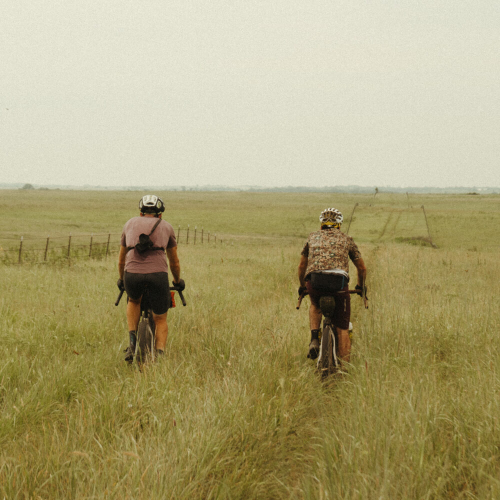
From Clarendon to Wheeler, you ride through classic Texas Panhandle landscapes: long, steady, mild climbs and descents through cattle ranches, shallow or dry creeks, and into expansive spaces that most folks visualize when thinking about the land that makes up Texas. You’ll cross three forks of the Red River between Quitaque and Wheeler, and you won’t wonder where it got its name. Take care for open range and the occasional driver in this relatively quiet part of the state.
After leaving Wheeler, you’re just a short 20-mile ride to the Oklahoma border. Take a picture of you with the state sign for both states. You earned at least that after the nearly 1,150 miles you put behind you.
This section has more pavement than other sections of the Great Plains Gravel Route. But on many portions of the route the distinction between pavement and gravel may be hard to tell. There are large sections of road that are simply single lane chip-seal county roads that were once gravel. Additionally, pavement roads were chosen in some areas between Big Spring and Lubbock simply for riding speed/efficiency and to avoid getting bogged down in sand all day long. The potential for some of those farm roads being six-inch deep sand is high in some seasons. A rider can certainly increase their percentage of gravel/dirt in that area since the roads are laid out in a grid for the most part, but that decision will depend on the season and road conditions.
- Paved: 45%
- Smooth Gravel: 20%
- Rough Gravel: 35%
- 4×4 Road: 0%
- Singletrack: 0%
Ideally, a gravel bike with clearance for two-inch tires will allow for efficient and comfortable riding along most of the route. Sandy stretches along farmland and deep draws in the Big Bend region may likely need to be walked at times, regardless of tire width. Riders on mountain bikes will not enjoy exceeding 2.4-inch tires, even those being slow-going for much of the route. Chunky conditions are intermittent, and an aggressively knobby tire is not necessary. If riding a bike with a 2X drivetrain, a large front ring ranging from 46t-48t will work splendidly for most of the route, and a small ring between 31t-34t may come in handy for some of the steeper climbs.
Unfortunately, bike shops are not frequent along the route, so a rider needs to be relatively self-sufficient and the bike in good mechanical order. Velocity Bike Shop in Lubbock, Texas, is an excellent service venue should you need anything as you pass through the largest city on the route.
Texas is hospitable, but it’s also mostly private land. In particular, the area this route traverses is extremely rural and often void of places to tent camp. Do NOT trespass, and plan ahead accordingly.
Public land is few and far between where the route traverses. Camping can be found at several state parks along the route, and in some cases, city parks. RV parks are also likely to host tent campers. It is always best to call ahead to all of these types of camping locations to ensure availability. Although water should not be an issue along the route, keep in mind that there are long stretches between population centers in several areas, so plan accordingly.
Each town/city identified should have at least one convenience store unless specified. Water should not be an issue, but for those longer stretches between population centers, it’s best to scrutinize your carrying capacity. This area of the state is semi-arid/arid in most circumstances, so even filtering water is not an option for the majority of it. Although riders will cross several rivers along the route, they are often in or near a city or town, diminishing the need to filter water.
Due to lack of connecting gravel infrastructure (a lot of Texas is actually paved), there is often the need to connect dirt with rural paved single or two-lane roads. Although effort was made to identify quieter roads for these connectors, practice extreme caution when taking them from one stretch of dirt to the next. The speed limit in Texas is higher than in most states, and the vehicles tend to be larger in rural areas.
The route between Presidio (the Rio Grande) and Ozona is the most remote, even though a sizable chunk of it is on a paved highway. Big Bend country is known for its lower population, but that also means that aid and services (like cell coverage) are much lower or hard to acquire. Likewise, plan to do most of your traveling through this area during the day. Border activity largely presents no problem at all, but the remoteness of the area does make it an attractive migratory route.
Lastly, make sure you are always communicating your travel plan to those you necessary to keep in the know. It’s never a bad idea to carry an emergency GPS device, like a SPOT or Garmin inReach. Although cell coverage is likely average to decent in most areas north of Interstate 20, there are pockets of no coverage.
Getting to the route: The Southern terminus of this route can be a challenge to get to, something bikepackers are not totally unfamiliar with (ie. Antelope Wells, the Southern terminus of the Great Divide Mountain Bike Route). Here are some of our recommendations for riders that are interested in riding the full Great Plains Gravel Route starting at the Mexican border which give you a few options other than having someone drop you off at the start:
- West Texas Adventure Co in Marfa offers airport shuttles from El Paso or Midland/Odessa airport to Marfa. Riders could inquire about booking additional transport through them from Marfa to Presidio.
- You could extend your cycling adventure by starting in El Paso and taking a portion of Adventure Cycling Association’s Southern Tier Route from El Paso to Marfa.
- Riders may choose to start their ride in Marfa if they would prefer to avoid the most rugged and isolated portion of the route between Presidio and Marfa.
- Otherwise, if wanting to officially start at the border, here is an alternative route from Marfa to Presidio to avoid backtracking, which takes Pinto Canyon Road – an incredibly scenic and rugged road to the border and then follows the border road for approximately 30 miles. There are no services or camping options along this route so riders will need to be prepared to make the 90-mile push in one day.
- There is a Uhaul rental in Alpine, TX so renting a one-way Uhaul is one way to get close to the start of the route despite not having traditional car rental agencies nearby.
- Another option, which would be a good one if you wanted to skip about 200 paved road miles at the beginning of the route, would be to get a one-way rental to Del Rio, Texas. There is an Enterprise Rent-A-Car there. From there, it is a short ride to join the route in Langtry. This is along the border so you would still get a border-to-border experience if that is important to you.
- If you are looking to just ride a section of the route, aim to identify sections between larger communities and/or public land where a vehicle can be left at either end of your route. Since this area of the state is expansive, it’s rather expensive to depend on shuttles.
Find the full route collection for the Great Plains Gravel Route in Ride with GPS here.
Creator of the Texas segment of the Great Plains Gravel Route, Jerod Foster was the first to traverse an early version of the full route on two wheels (although the moto-powered kind). He did this as a part of a documentary project with writer Brandon Weaver and students from his Texas Tech Adventure Media Studies course. Read dispatches and see photo essays from the trip at www.thegreatplainsproject.com. Additional media products from this adventure are forthcoming.
Jerod Foster created and stewards this route. Here is a little about Jerod in his own words:
I am an adventure travel and conservation photographer and filmmaker who frequently involves bikepacking into both editorial and commercial work. My clients include The Nature Conservancy, Texas Parks & Wildlife, The New York Times, and a host of regional and international platforms. I have been an assistant editor for The Bikepacking Journal since its third issue, as well as a semi-regular contributor. Likewise, I am an editor for OutdoorX4 Magazine.
I am an ambassador for Chumba USA, a handmade bicycle manufacturer in Austin, Texas. My ambassadorship largely revolves around my work in field-based higher education (noted below), as well as my media work in the bikepacking realm. Part of my role (albeit a small one) with Chumba has culminated in the development of the Yaupon, a drop-bar mountain bike that I have used almost exclusively for long cycling tours and bikepacking trips since I tested the prototype in 2022.
I’m also a professor of practice at Texas Tech University, where I teach several field-based immersive experiences that incorporate backcountry travel, including the award-winning Adventure Media program that combines bikepacking across the Southwest with documentary and commercial media production education. I have led and co-led two field programs focused specifically on the Great Plains Gravel Route, one in 2022 that followed my cycling tour from Stillwater, Oklahoma, to the Nebraska/South Dakota border, and the second in 2024 that followed my travels with writer Brandon Weaver along the entire route, from Mexico to Canada, on adventure motorcycles. This latter program’s production will result in a six-part PBS series entitled The Great Plains Project.
Prior to joining the team that created this route, I began a six-year-long documentary project on the Great Plains centered around a similar route from Lubbock, Texas, to Calgary, Alberta. As research occurred while riding large sections of the route, I became connected to and joined several members of the consortium that ultimately put this final route together.
My hope is that everyone that rides all or parts of this national route glean from their experience much more than what laid immediately in front of their tires, but rather embraced the land, the people, and the history surrounding the route, because the Great Plains is one of the most important places IN THE WORLD, FOR THE WORLD.
Jerod would like to give the following acknowledgements for other important contributors to this route:
- My brother, Seth Foster, helped me tremendously develop the northern portion of the state’s route during our initial Great Plains Project route creation.
- Trail Warrior’s Odis Franklin was very helpful in imagining and developing a route around the oilfields of the Permian Basin, no small task given that gravel roads in that area are fraught with heavy and fast traffic or simply dead-end at pumpjacks.
- Writer and podcaster Brandon Weaver helped check the viability of the state and national route while riding it on motorcycles in Fall 2024. His cycling and route experience was a big consult on ensuring its rideability.
- Jake Gosschalk, a cycling colleague of mine, played a not-so-small role in encouraging the route around the Permian Basin, a stressful decision since it added quite a bit of mileage to an already large state route.
Jerod has offered to be available to answer questions if you are planning a trip on this route.
Please also get in touch with any updates on route conditions that may be relevant to other riders.
Please submit your questions and comments on the route via the contact form below.
This route traverses the traditional lands of the Mescalero Apache, Lipan Apache, Comanche, and Kickapoo.