Route Overview
Region
Miles
Days Out
Recommended Tire Size
Season
Fall into Late Fall
Elevation Gain
Difficulty
6/10 Technical
Primary Surface(s)
Rough Gravel


Route Map
Route Details
This route traverses remote Basin and Range landscape with cool historical and even prehistoric points of interest.
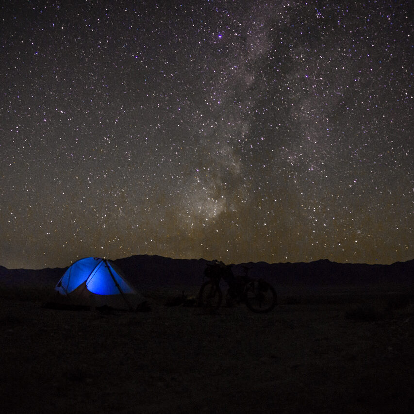
Highlights include many abandoned charcoal kilns, historical stage routes and stations, and the darkest of dark skies – the route’s namesake.
*And yes, Dark Sky’s is not a typo – the name came to Doug and Kurstin while bikepacking, and the possessive ‘belonging to the Dark Sky’ seemed fitting.
A roughly 2-week (+/-) route through remote Nevada back roads traversing many mountain ranges and long valleys. Geologically, the route is very diverse. This route is well adorned with historic stage routes, stage station remains, unmarked old charcoal kilns, and prehistoric rock art. Abandoned ranches beg your mind to conjure the stories of what life here was like.
Water is key, but thankfully can be obtained at somewhat reasonable distances. Pay attention to your stocks and take into account that many areas of this route are on very slow sandy tracks and/or hike-a-bike. Plan accordingly. Dispersed camping is available most anywhere, as most of the route is BLM or Forest Service. Plus tired bikes rule out here, and with the amount of sand we encountered, I wouldn’t want anything less and occasionally wished for more.
Inspired by and building on the Comstock Epic Route by Trevor Oxborrow, “Dark Sky’s” attempts to put together interesting points of interest with water and resupply at reasonable mileages. The route takes you over a few smaller saddles, then through Fish Lake Valley and scenic Box Canyon. Climbing Kiln Canyon, view the old charcoal kiln, and complete the tough push over the top of the Hot Creek Range and drop to Tybo ghost town.
Continue along the eastern edge of the Hot Creek Range until once again you climb up via Sixmile Canyon. More charcoal kilns greet you, and another tough hike a bike over the top of Sixmile summit. Descend to Moore’s Station. I recommend the short side trip down to view the petroglyph panels just beyond the privately held Moore’s Stage station. Head back north, and Pritchard’s Stage Station is an interesting site.
Cross Little Smokey and Big Sand Springs Valley, cross the Pancake Range, and pass through Duckwater Tribal Reservation and hit paved Hwy 379. Leave the highway again at Currant and pass along the base of Ragged Ridge. At the “Stone House,” find a cattle trail crossing the wash and pick up a sandy road. Cross the Horse Range and make your way to Preston, where you may want to recuperate overnight, eat at the cafe, and resupply at the nice All In One truck stop.
After Preston, head into the Egan Range via beautiful Sawmill Canyon. A longish day can see you through to Cave Lake State Park and Elk Flat campground. The Gandy Loop section is next. You can choose to stay and or eat at the cafe at the Border Inn. Limited resupply. Head north, and with prior notice, the Bates Family Ranch may be able to accommodate you and provide a tour of Crystal Ball Cave. Leaving the ranch, you soon pass the Gandy Warm Spring. Don’t miss this beautiful spot. An easy climb leads you up through a gap between the Snake Range and the Kern Mountains back into Spring Valley. A long climb up over Kalamazoo Pass in the Schell Creek Range, and you can make it to Ely for another well-deserved rest.
Leaving Ely, you can make it back to Preston and top off your supplies or spend another night. Leave Preston and climb into the White Pine Range with a rich mining history. Make the side trip up to Shermantown, you’ll be happy you did. Continue down and hike your bike through lower Cathedral Canyon with its towering walls and arches. Take a break and fill your water at the oasis of Green Springs.
You’re on the homeward leg! Cross rolling terrain and the remains of Pogue’s Station. Cross Little Smokey Valley, Antelope Valley, and pick up your last water supply at Allison Creek. There’s nothing left to do but roll north to Hwy 50 and back to your vehicle.
You did it!
- Paved: 16%
- Smooth Gravel: 36%
- Rough Gravel: 34%
- 4×4 Road: 14%
- Singletrack: 0%
A note about the Dark Sky’s Bikepacking route: This route traverses remote areas in one of the least densely populated areas of the United States. The trail features challenging hike-a-bike sections as well as long sandy stretches, making the proper bike and tire choice critical.
Be prepared for a range of conditions and remote, isolated settings. Ensure you have enough battery power and a backup form of navigation. Ensure you are prepared to handle any bike mechanicals that you may encounter.
A satellite communication device is highly recommended in the event you find yourself in trouble. You may go several days without seeing anyone, and cell service is certainly spotty.
Water
- Having a means to treat water is required for this route.
- Doug suggests a 7-liter capacity due to the distance between confirmed sources, potential heat, and slow travel.
- There are multiple ~60-mile stretches on sandy track without water.
Re-supply
- Resupply is limited along this route. Riders should plan to have adequate food storage capacity.
- The longest stretch without food resupply on this route is ~250 miles, or 4-6 days.
Camping
- This route offers plentiful dispersed camping options, as the majority of it is on BLM or Forest Service land.
- Bicycles are not allowed within Wilderness or Wilderness Study Areas. These boundaries are marked on the RideWithGPS file as POIs. Please plan your camping around these areas.
- The route does cross small parcels of private land, mainly ranches. Please be cognizant of this and ensure you are camping on public land. We recommend utilizing a map with a private land layer such as GAIA GPS or OnX for reference.
Parking
- The area designated at the start and end of the route is a pull-off / materials staging area on BLM land (typical parking situation for Nevada). It is accessed by a separate ancillary dirt road coming in from both the east and west sides of the area and is about 1/2 miles in a straight line off of Hwy 50. Don’t park directly next to a materials pile.
- If you plan to leave a vehicle on public land, consider leaving a note on the front seat that explains your intention and when you plan to return, with contact information in case of emergency.
- If you choose to start the route in Ely, NV, the convention center downtown is an option for extended parking. You can reach out to Kyle Horvath at [email protected] if you would like to confirm long-term parking details.
Riding Season
Best riding seasons are late spring/early summer or fall, sometimes into November. Early spring likely holds too much snow in the passes and typical late season storms. Summer would be very hot, and winter could be wet, death mud, snowy, particularly trying to cross the passes. Altitudes range from ~5k to ~9k so in the prime season you can expect warm to hot days and cool to cold nights. In spring/early summer you may encounter blazing heat or late winter storms and snow still on the high passes. No see-ums can make an appearance in late May-June. In fall you may have to contend with early winter storms, and/or heat and late season water issues, but no bugs
Bike Selection Notes
This route is suitable for mountain or fat tire bikes.
While the route could be done with skinnier gravel tire bikes, overall, you will encounter conditions that are much more suitable for 2.6″ to plus-sized tires.
Fat tires are overkill, but you can certainly appreciate them, as there are times that you’d be happy to have them.
Doug has a few blog posts that outline his ride on the Dark Sky’s route:
- https://its4pm.blogspot.com/2024/11/dark-skys-bikepacking-journey.html
- https://its4pm.blogspot.com/p/new-bikepacking-routes-of-nevada.html
Kurstin Graham also has a blog post about his ride with Doug, including a daily log:
The Dark Sky’s route is the work of Doug Artman.
Doug would like to thank Trevor Oxborrow for creating the “Comstrock Epic” route/race which inspired this route, as well as his riding partner Kurstin Graham for help scouting the route.
Here are a few words from Doug:
Upon retirement in 2015, I renewed my love affair with bikes following a long climbing addiction. I’ve always had a strong love for adventure and began combining bikes with other forms of adventure, such as hiking and packrafting. I’ve planned and executed such diverse adventures as climbing Mt. Logan in the Yukon, climbing seldom-visited summits in the Waddington Range of British Columbia, and, more recently, canyoneering/bikerafting the Green River, hiking/packrafting various areas of Lake Powell, as well as many self-created bikepacking routes in Nevada. My favorite winter pastime is finding interesting areas on maps and trying to link them all in a bikepacking route. I love Nevada and call Nevada my home.
Doug has offered to be available to answer questions if you are planning a trip on this route. We encourage you to be respectful of Route Stewards’ time, though, and to review publicly available materials first before reaching out with questions.
Please also get in touch with any updates on route conditions that may be relevant to other riders.
Please submit your questions and comments on the route via the contact form below.
This route traverses the traditional lands of the Western Shoshone.