

By Matt Mason, Bikepacking Roots’ Board Member and Route Creator
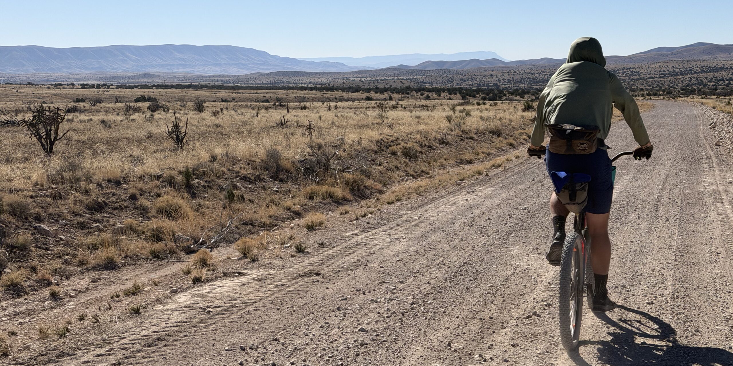
We laid our bikes on Forest Road 67, making no effort to move them to the side as we hadn’t seen a vehicle all day, and walked a few hundred yards through a mix of gramma grasses, agaves, and junipers to the edge of a limestone cliff. Our view included a Roadless Area, a Wilderness Study Area, four Areas of Environmental Concern, a National Park, a National Forest, historic and archaeological sites, one of the largest intact Chihuahuan Desert grasslands, and the small community of Dell City, Texas. Instead of providing a traditional trip report, I’ll dive into how it came to be that we were there and how bikepackers fit into the public lands advocacy space going forward.
If I were to make a phylogenetic tree of outdoor recreation activities, bikepacking would be most closely related to backpacking. The fact that we appear similar to mountain bikers is a case of convergent evolution. Instead of looking for jump lines and speedy descents (we’ll happily go downhill!) bikepackers tend to prefer lonely dirt roads through National Monuments, scenic backcountry byways, historical sites, and small town charm…meaning food. Bikepackers seek connection with and understanding of the places we ride. Often that leads us directly to post-ride advocacy efforts protecting wild places. Occasionally the advocacy itself is what motivates the riding and that’s the case here.
I first visited Otero Mesa in 2010 as part of a Rangeland Grasses course at New Mexico State University. Dr. Kelly Allred saw my enthusiasm for grasses and suggested I spend my spring break on the Mesa. Deal. For a few days I crisscrossed the area, watching badgers, finding petroglyphs, and identifying grasses. Bouteloua eriopoda ( I recommend learning scientific names!) was abundant despite being a rarity in the desert just an hour to the west. It wasn’t until 2018 that I returned to the area for a day of biking in 2018. Poor planning left me repeatedly stymied by locked gates, but the unique beauty of the area led me to create a longer bikepacking route once I returned home.

My RideWithGPS has an unnamed route created in 2018 that I never rode. Life got busy, I went to other places, excuses on excuses. Then in early 2026 I met with Bjorn Fredrickson from New Mexico Wild. NM Wild has been advocating for decades to protect Otero Mesa from, “threats like oil and gas development, mining, groundwater withdrawals and export, unmanaged motorized recreation, and proposals to sell-off our public lands.” Bjorn wondered if creating a bikepacking route was possible and if doing so could help build awareness for protecting the Mesa. Yes and yes! Immediately I was intrigued, not only because I enjoy making routes, but because it was refreshing to have dedicated wilderness advocates reaching out to and seeing value in the bikepacking community. We’re more similar than different and our goals often align so it makes sense to collaborate but historically bikers, hikers, equestrians, and motorized users tended to stick to themselves which left us with suboptimal environmental outcomes.
Following a few hours of research (are you familiar with the El Paso Salt Wars) and a few more hours of mapping I had a new unridden route in my RideWithGPS collection. All routes are great if you only ride them from your office chair in satellite view! The next step was of course to go put eyes and wheels on the line I’d drawn and find the answer to the ultimate question, “Can I ride it on my gravel bike?”. Spoiler alert, you can!
My friend Phil Simpson came along on the first scouting trip which centered on making the connection from the village of Piñon (population 24) to Rim Road. This crucial section gave us a feel for the paradox of the roads. Despite seeing only one car in 48 hours the roads were well maintained and pleasant to ride. Why remote roads would be in such good shape we didn’t understand but we also didn’t argue. The western portion of the route technically isn’t on Otero Mesa but provides some huge views from the ridge that makes up the bulk of the Guadalupe Ranger District in Lincoln National Forest. We saw mule deer, elk, and a wide variety of birds. For about 20 miles the route borders a Roadless Area in this section.
A few weeks later we returned to drive and ride the rest of the route over a few days. This time we chose to start our rides at Campfire Adventure Ranch near Dell City. The Ranch proved to be a perfect place for bikepackers to start the route, park their car, and tap into some local knowledge. Our second trip was much like the first. We spotted pronghorn, marveled at the unbroken miles of grasses, and reveled in the solitude on the Mesa. I made a few minor route corrections following that second visit, verified it with the local BLM Office and the route was ready to roll.
Wayfaring Stranger – I have a habit of naming routes after traditional folk songs – is now live on the Bikepacking Roots route pages. My hope is that this fall when folks start riding it, they’ll fall in love with the mix of well graded roads, dark skies, wildlife, and grasslands that provide a glimpse of what much of the Chihuahuan Desert once was. Perhaps I’m dreaming, but since bikepackers have proven to be extremely knowledgeable public land users and skilled advocates I’m hoping this route will be another step towards protection for this unique resource when they start sharing stories of their trips. Even if we wait another decade for the public to realize the value of Otero Mesa, Representative Vasquez already understands the win of New Mexico Wild and Bikepacking Roots working together and that work to protect this special place will continue on.
